Malaucourt-sur-Seille
| Malaucourt-sur-Seille | ||
|---|---|---|
|
| |
| Staat | Frankreich | |
| Region | Grand Est | |
| Département (Nr.) | Moselle (57) | |
| Arrondissement | Sarrebourg-Château-Salins | |
| Kanton | Le Saulnois | |
| Gemeindeverband | Saulnois | |
| Koordinaten | 48° 50′ N, 6° 22′ O | |
| Höhe | 191–276 m | |
| Fläche | 7,17 km² | |
| Einwohner | 127 (1. Januar 2019) | |
| Bevölkerungsdichte | 18 Einw./km² | |
| Postleitzahl | 57590 | |
| INSEE-Code | 57436 | |
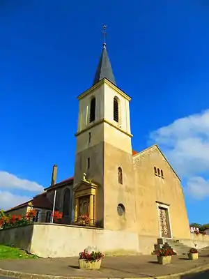 Mariä-Himmelfahrt-Kirche | ||

Malaucourt-sur-Seille ist eine französische Gemeinde mit 127 Einwohnern (Stand 1. Januar 2019) im Département Moselle in der Region Grand Est (bis 2015 Lothringen). Sie gehört zum Arrondissement Sarrebourg-Château-Salins.
Geografie
Die Gemeinde Malaucourt-sur-Seille liegt zehn Kilometer westlich von Château-Salins im Saulnois auf einer Höhe zwischen 191 und 276 m über dem Meeresspiegel. Das Gemeindegebiet umfasst 7,17 km². Im Südwesten reicht das Gemeindegebiet bis an die Seille an der Grenze zum Département Meurthe-et-Moselle.
Geschichte
Das Dorf gehört seit 1661 zu Frankreich und trug 1915–18 bzw. 1940–44 den verdeutschten Namen Mallhofen.
Bevölkerungsentwicklung
| Jahr | 1962 | 1968 | 1975 | 1982 | 1990 | 1999 | 2007 | 2015 |
| Einwohner | 118 | 128 | 101 | 98 | 112 | 143 | 129 |
Weblinks
Commons: Malaucourt-sur-Seille – Sammlung von Bildern, Videos und Audiodateien
This article is issued from Wikipedia. The text is licensed under Creative Commons - Attribution - Sharealike. The authors of the article are listed here. Additional terms may apply for the media files, click on images to show image meta data.