Liste europäischer Inseln nach Fläche
Dies ist eine Liste europäischer Inseln (nach Fläche). Binneninseln sind in der Regel nicht aufgeführt.

Karte der 50 größten europäischen Inseln (die 15 größten orange gefärbt, die 35 nächstgrößten rot)
Inseln mit einer Fläche von mehr als 200 Quadratkilometern
| Rang | Bild | Insel | Fläche in km² | Staat / Region | Lage / Anmerkungen |
|---|---|---|---|---|---|
| 1 | 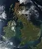 Satellitenbild von Großbritannien | Großbritannien | 229.848 | Größte Insel Europas | |
| 2 | 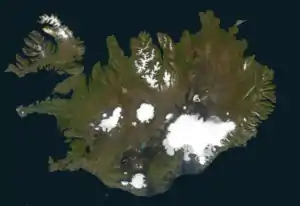 Satellitenaufnahme von Island | Island | 101.826 | ||
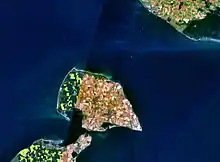
| 3 | 12.jpg.webp) Satellitenaufnahme von Irland | Irland | 84.421 | Mit 70.273 km² ist die Republik Irland das größte Inselterritorium der Europäischen Union | |
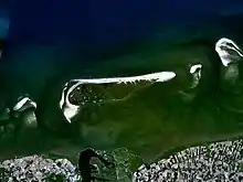
| 4 | 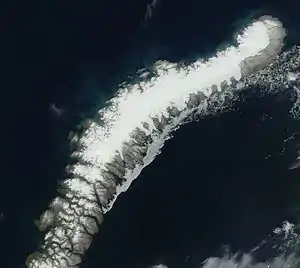 | Nordinsel (Nowaja Semlja) Северный остров | 47.079 | Größte Insel Russlands in Europa | |
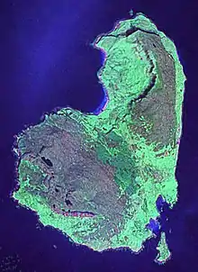
| 5 | 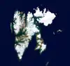 Satellitenaufnahme Spitzbergens | Spitzbergen Spitsbergen | 37.673 | Größte norwegische Insel, Inselgruppe Spitzbergen | |
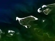
| 6 | 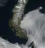 | Südinsel (Nowaja Semlja) Южный остров | 33.246 | ||
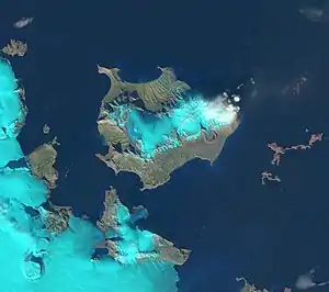
| 7 | 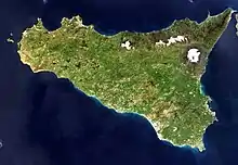 Satellitenaufnahme Siziliens | Sizilien | 25.662 | Größte Insel Italiens und des Mittelmeers
Größte Insel, die in der Europäischen Union vollständig enthalten ist | |
| 8 | 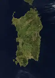 Satellitenaufnahme von Korsika und Sardinien | Sardinien | 23.949 | ||
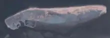
| 9 | 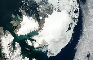 Satellitenaufnahme des Nordostlands | Nordostland Nordaustlandet | 14.443 | Inselgruppe Spitzbergen | |
| 10 | 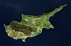 Satellitenaufnahme Zyperns | Zypern | 9.251 | Wird geographisch zu Asien gerechnet | |
| 11 | 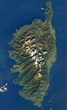 | Korsika | 8.741 | Größte französische Insel in Europa | |
| 12 | Satellitenaufnahme Kretas | Kreta | 8.312 | Größte griechische Insel | |
| 13 |  | Seeland Sjælland | 7.180 | Größte dänische Insel und größte Insel in der Ostsee | |
| 14 |  | Edgeøya | 5.074 | Inselgruppe Spitzbergen | |
| 15 |  | Vendsyssel-Thy Nordjütische Insel | 4.685 | ||
| 16 | 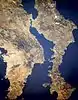 Satellitenaufnahme von Euboea | Euböa | 3.655 | ||
| 17 | 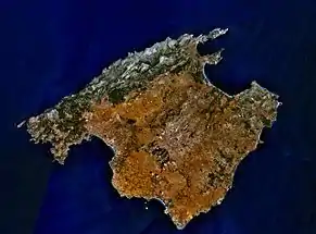 | Mallorca | 3.640 | Größte spanische Insel in Europa | |
| 18 |  | Kolgujew Колгуев | 3.497 | Liegt im Autonomen Kreis der Nenzen | |
| 19 | 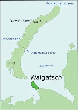 | Waigatsch Вайгач | 3.329 | ||
| 20 | 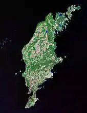 Satellitenaufnahme von Gotland | Gotland | 2.994 | Größte schwedische Insel | |
| 21 | 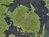 | Fünen Fyn | 2.984 | ||
| 22 | Prinz-Georg-Land Земля Георга | 2.821 | Inselgruppe Franz-Josef-Land | ||
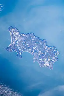
| 23 | 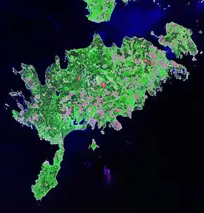 | Saaremaa Ösel | 2.672 | Größte estnische Insel | |
| 24 | 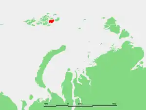 | Wilczek-Land Земля Вильчека | 2.203 | Inselgruppe Franz-Josef-Land | |
| 25 | Hinnøya | 2.198 | Größte norwegische Insel außerhalb der Inselgruppe Spitzbergen | ||
| 26 | 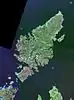 Satellitenaufnahme von Lewis | Lewis and Harris | 2.179 | ||
| 27 | 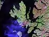 Satellitenaufnahme von Skye | Skye | 1.656 | ||
| 28 | Soisalo | 1.638 | Größte finnische Insel und größte Binneninsel in Europa | ||
| 29 | 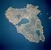 Satellitenaufnahme von Lesbos | Lesbos | 1.630 | ||
| 30 | Senja | 1.586 | |||
| 31 | Graham-Bell-Insel Остров Греэм-Белл | 1.557 | Inselgruppe Franz-Josef-Land | ||
| 32 | 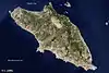 Satellitenaufnahme von Rhodos | Rhodos | 1.398 | ||
| 33 | Satellitenaufnahme von Öland | Öland | 1.347 | ||
| 34 | 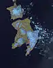 | Barentsøya dt. Barentsinsel | 1.288 | ||
| 35 | Lolland | 1.243 | |||
| 36 | Alexandraland Земля Александры | 1.095 | Inselgruppe Franz-Josef-Land | ||
| 37 | Hall-Insel Остров Галля | 1.049 | Inselgruppe Franz-Josef-Land | ||
| 38 | 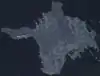 | Hiiumaa Dagö | 989 | ||
| 39 | 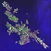 | Mainland (Shetland) | 969 | ||
| 40 |  | Salisbury-Insel Остров Солсбери | 960 | Inselgruppe Franz-Josef-Land | |
| 41 | 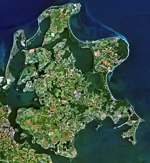 Satellitenaufnahme von Rügen | Rügen | 926 | Größte deutsche Insel | |
| 42 | Isle of Mull | 875 | |||
| 43 | Langøya | 850 | |||
| 44 |  Satellitenaufnahme von Chios | Chios | 842 | ||
| 45 | Sørøya dt. Südinsel | 811 | |||
| 46 |  | Kefalonia | 781 | ||
| 47 |  | São Miguel dt. Sankt Michael | 759 | Größte portugiesische Insel | |
| 48 | Meschduscharski Междушарский остров | 748 | Inselgruppe Franz-Josef-Land | ||
| 49 | Satellitenaufnahme von Madeira | Madeira | 741 | gehört geographisch zu Europa, geologisch aber zu Afrika | |
| 50 | Kvaløya dt. Walinsel | 737 | |||
| 51 | Anglesey walisisch Ynys Môn | 714 | |||
| 52 | 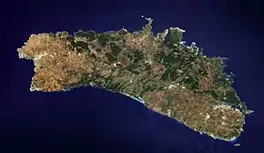 | Menorca | 694 | ||
| 53 | Fasta Åland finn. Manner-Ahvenanmaa | 685 | |||
| 54 | Kvitøya dt. Weiße Insel | 682 | |||
| 55 | Ringvassøy | 656 | |||
| 56 | 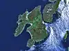 Satellitenaufnahme von Islay | Islay | 620 | ||
| 57 | Prins Karls Forland | 615 | Inselgruppe Spitzbergen | ||
| 58 | McClintock-Insel Остров Мак-Клинтока | 612 | Inselgruppe Franz-Josef-Land | ||
| 59 | Satellitenaufnahme von Korfu | Korfu | 592 | ||
| 60 | 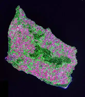 Saltellitenaufnahme von Bornholm | Bornholm | 588 | ||
| 61 | Hitra | 572 | |||
| 62 | 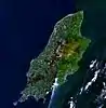 Satellitenbild der Isle of Man | Isle of Man | 572 | Kronbesitzung der britischen Krone | |
| 63 | 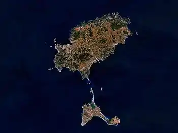 | Ibiza | 571 | ||
| 64 | Seiland | 559 | |||
| 65 | Austvågøya | 527 | Inselgruppe Lofoten | ||
| 66 | Kimitoön (schwed.) finn. Kemiönsaari | 524 | Im Schärenmeer | ||
| 67 |  Satellitenaufnahme Orkneys | Mainland (Orkney) | 523 | ||
| 68 | Jackson-Insel остров Джексона | 521 | Inselgruppe Franz-Josef-Land | ||
| 69 | Falster | 514 | |||
| 70 | Andøya | 489 | |||
| 71 | La-Ronciere-Insel Ла-Ронсьер | 478 | Inselgruppe Franz-Josef-Land | ||
| 72 | 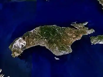 Satellitenaufnahme von Samos | Samos | 476 | ||
| 73 |  | Lemnos | 476 | ||
| 74 | Hooker-Insel остров Гукера | 460 | Inselgruppe Franz-Josef-Land | ||
| 75 | | Ziegler-Insel Остров Циглера | 448 | Inselgruppe Franz-Josef-Land | |
| 76 | Pico | 446 | Insel der Azoren | ||
| 77 | 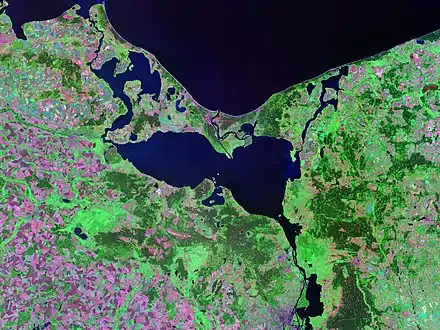 | Usedom | 445 | ||
| 78 | Magerøya | 437 | wörtlich karge Insel | ||
| 79 | 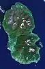 | Isle of Arran | 432 | ||
| 80 | Naxos | 428 | |||
| 81 | Vestvågøy | 411 | |||
| 82 | 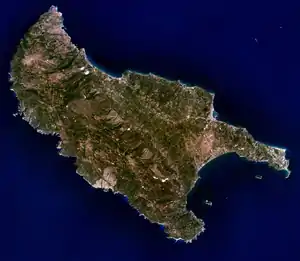 | Zakynthos | 406 | ||
| 83 | 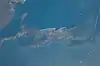 Satellitenaufnahme von Cres | Cres | 406 | Größte Insel Kroatiens | |
| 84 |  Satellitenaufnahme von Krk | Krk | 406 | ||
| 85 | 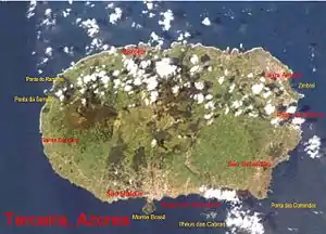 | Terceira | 403 | Azoren | |
| 86 | Brač | 395 | |||
| 87 |  Satellitenaufnahme der Isle of Wight | Isle of Wight | 381 | Südküste Englands | |
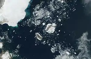
| 88 |  Satellitenaufnahme der Insel Jan Mayen | Jan Mayen | 380 | Europäisches Nordmeer/Grönlandsee | |
| 89 | Andros | 380 | |||
| 90 | 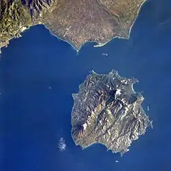 | Thasos | 379 | ||
| 91 | | Champ-Insel Чамп | 374 | Inselgruppe Franz-Josef-Land | |
| 92 | .jpg.webp) | Streymoy dän. Strømø | 374 | Größte Insel der Färöer | |
| 93 | Luigi-Insel Остров Луиджи | 371 | Inselgruppe Franz-Josef-Land | ||
| 94 | Mors auch Morsø oder Morsland | 368 | |||
| 95 | 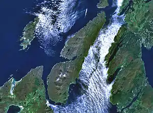 Satellitenaufnahme von Jura | Jura | 367 | Innere Hebriden | |
| 96 | 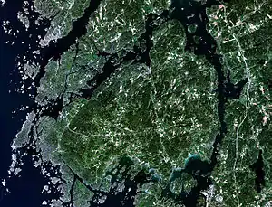 Satellitenaufnahme von Orust | Orust | 346 | An der Westküste Schwedens | |
| 97 | Salm-Insel Сальм | 344 | Inselgruppe Franz-Josef-Land | ||
| 98 | Kvaløya | 336 | |||
| 99 | Karl-Alexander-Insel Остров Карла-Александра | 329 | Inselgruppe Franz-Josef-Land | ||
| 100 | Osterøy | 329 | |||
| 101 | Als | 321 | |||
| 102 | South Uist | 320 | Äußere Hebriden | ||
| 103 | 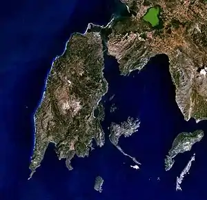 | Lefkada | 303 | ||
| 104 | 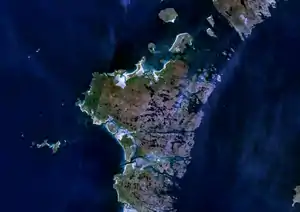 | North Uist | 303 | Äußere Hebriden | |
| 105 | Karpathos | 301 | |||
| 106 | Hvar | 300 | |||
| 107 | 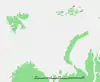 | Rudolf-Insel остров Рудольфа | 296 | Inselgruppe Franz-Josef-Land | |
| 108 | Kos | 290 | |||
| 109 | 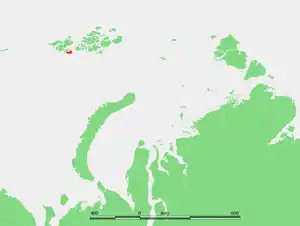 | Northbrook-Insel Остров Нортбрук | 289 | Inselgruppe Franz-Josef-Land | |
| 110 | 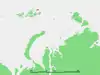 | Eva-Liv-Insel Остров Ева-Лив | 288 | Inselgruppe Franz-Josef-Land | |
| 111 | Eysturoy dän. Østerø | 286 | |||
| 112 | Pag | 285 | |||
| 113 | Langeland | 284 | |||
| 114 | Gökçeada | 279 | Größte türkische Insel in Europa | ||
| 115 | Kythira | 278 | |||
| 116 | Korčula | 276 | |||
| 117 | Arnøya | 276 | |||
| 118 | | Wolin dt. Wollin | 265 | ||
| 119 | Ikaria | 255 | |||
| 120 | Solowezki Соловецкий | 246 | Inselgruppe Franz-Josef-Land | ||
| 121 | 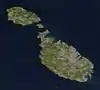 Satellitenaufnahme von Malta | Malta | 246 | ||
| 122 | 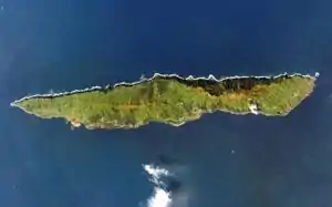 | São Jorge dt. Sankt Georg | 246 | Insel der Azoren | |
| 123 |  | Stord | 241 | ||
| 124 | | Wiener-Neustadt-Insel Остров Винер-Нейштадт | 237 | Inselgruppe Franz-Josef-Land | |
| 125 | Vanna auch Vannøya | 232 | |||
| 126 | Stjernøya | 231 | |||
| 127 | Møn | 226 | |||
| 128 |  Satellitenaufnahme von Elba | Elba | 224 | ||
| 129 | Smøla | 218 | |||
| 130 | Yell | 212 | Shetland | ||
| 131 | 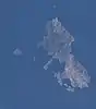 | Skyros | 209 | ||
| 132 | Muhu dt. Moon/Mohn | 206 |
Inseln mit einer Fläche von 100 bis 200 Quadratkilometern
Satellitenaufnahme von Fehmarn
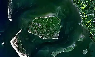
Satellitenaufnahme von Kongsøya und Svenskøya
Satellitenaufnahme von Wilhelmøya
Satellitenbild von Jersey
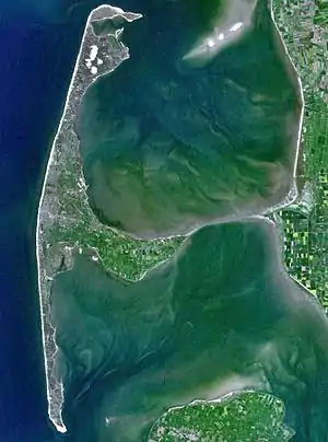
Satellitenaufnahme von Sylt

Satellitenaufnahme von Amager
Satellitenaufnahme von Föhr
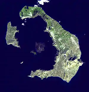
Satellitenaufnahme von Santorin
Satellitenaufnahme der Île de Noirmoutier

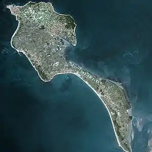
Satellitenaufnahme von Ischia
Satellitenaufnahme von Schiermonnikoog
Satellitenaufnahme von Borkum
Satellitenaufnahme von Eigg
Satellitenaufnahme von Norderney
Satellitenaufnahme von Amrum
Die Liste ist nicht vollständig.
Inseln mit einer Fläche von 50 bis 100 Quadratkilometern
Diese Liste ist unvollständig. Es fehlen Daten einiger arktischer Inseln Russlands und von Spitzbergen.
Inseln mit einer Fläche von 20 bis 50 Quadratkilometern
Diese Liste ist unvollständig. Es fehlen Daten einiger arktischer Inseln Russlands und von der Inselgruppe Spitzbergen.
Anmerkungen
- Die Kanarischen Inseln sind kein Teil Europas, während Zypern als solcher angesehen wird, auch wenn es Meinungen gibt, dass es sowohl ein Teil Europas wie auch Asiens sei.
- Die arktischen Inseln Russlands werden als europäisch angesehen, wenn sie westlich der Jamal-Halbinsel liegen. Dies betrifft den Archipel des Franz-Josef-Landes, Nowaja Semlja, Kolgujew und Waigatsch. Spitzbergen fällt in die gleiche Gruppe.
- Grönland wird dagegen zu Nordamerika gerechnet.
- Die Daten von Bolschoi Berjosowy wurden aus Karten abgeschätzt.
Quellen
- http://islands.unep.ch/
- (also includes freshwater islands) (Memento vom 4. August 2007 im Internet Archive)
- http://www.intermin.fi/intermin/images.nsf/files/aaa29f826e98e26ac22572480031ab08/$file/esite_2007_eng.pdf
- http://www.ub.ntnu.no/formidl/utgivelser/til_opplysning/to_nr16.pdf
- http://www.kartverket.no/dnl/Den-norske-los-7-English.pdf
Siehe auch
This article is issued from Wikipedia. The text is licensed under Creative Commons - Attribution - Sharealike. The authors of the article are listed here. Additional terms may apply for the media files, click on images to show image meta data.