Marolles-sous-Lignières
Marolles-sous-Lignières ist eine französische Gemeinde mit 329 Einwohnern (Stand 1. Januar 2019) im Département Aube in der Region Grand Est (vor 2016 Champagne-Ardenne). Sie gehört zum Kanton Aix-en-Othe (bis 2015 Ervy-le-Châtel) im Arrondissement Troyes.
| Marolles-sous-Lignières | ||
|---|---|---|
| ||
| Staat | Frankreich | |
| Region | Grand Est | |
| Département (Nr.) | Aube (10) | |
| Arrondissement | Troyes | |
| Kanton | Aix-en-Othe | |
| Gemeindeverband | Chaourçois et du Val d’Armance | |
| Koordinaten | 47° 57′ N, 3° 55′ O | |
| Höhe | 119–192 m | |
| Fläche | 15,09 km² | |
| Einwohner | 329 (1. Januar 2019) | |
| Bevölkerungsdichte | 22 Einw./km² | |
| Postleitzahl | 10130 | |
| INSEE-Code | 10227 | |
| Website | http://www.marolles-sous-lignieres.fr/ | |
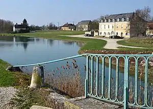 Anlegestelle am Canal de Bourgogne | ||

Geographie
Marolles-sous-Lignières liegt etwa 33 Kilometer südsüdwestlich von Troyes am Canal de Bourgogne. Nachbargemeinden sind Chessy-les-Prés im Norden, Lignières im Osten, Tronchoy im Südosten, Roffey im Süden, Bernouil im Südwesten sowie Flogny-la-Chapelle im Westen.
Bevölkerungsentwicklung
| Jahr | 1962 | 1968 | 1975 | 1982 | 1990 | 1999 | 2006 | 2011 | 2016 |
|---|---|---|---|---|---|---|---|---|---|
| Einwohner | 352 | 314 | 260 | 275 | 299 | 304 | 317 | 331 | 332 |
| Quelle: Cassini und INSEE | |||||||||
Sehenswürdigkeiten
- Kirche Saint-Germain-d’Auxerre
This article is issued from Wikipedia. The text is licensed under Creative Commons - Attribution - Sharealike. The authors of the article are listed here. Additional terms may apply for the media files, click on images to show image meta data.