Bouranton
Bouranton ist eine französische Gemeinde mit 594 Einwohnern (Stand 1. Januar 2019) im Département Aube in der Region Grand Est (vor 2016 Champagne-Ardenne); sie gehört zum Arrondissement Troyes und ist Teil des Kantons Vendeuvre-sur-Barse (bis 2015 Lusigny-sur-Barse). Die Einwohner werden Bourantonais genannt.
| Bouranton | ||
|---|---|---|

|
| |
| Staat | Frankreich | |
| Region | Grand Est | |
| Département (Nr.) | Aube (10) | |
| Arrondissement | Troyes | |
| Kanton | Vendeuvre-sur-Barse | |
| Gemeindeverband | Troyes Champagne Métropole | |
| Koordinaten | 48° 19′ N, 4° 11′ O | |
| Höhe | 109–171 m | |
| Fläche | 8,26 km² | |
| Einwohner | 594 (1. Januar 2019) | |
| Bevölkerungsdichte | 72 Einw./km² | |
| Postleitzahl | 10270 | |
| INSEE-Code | 10053 | |
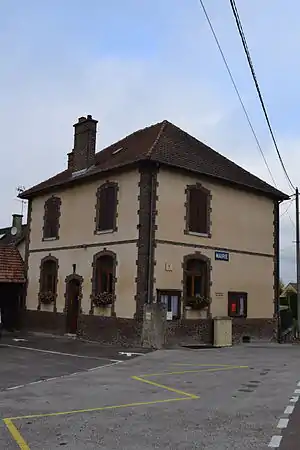 Mairie Bouranton | ||

Geographie
Bouranton liegt etwa acht Kilometer ostnordöstlich von Troyes. Umgeben wird Bouranton von den Nachbargemeinden Villechétif im Norden und Westen, Mesnil-Sellières im Norden und Nordosten, Laubressel im Osten und Südosten sowie Thennelières im Süden
Am Westrand der Gemeinde führt die Autoroute A26 entlang.
Bevölkerungsentwicklung
| Jahr | 1962 | 1968 | 1975 | 1982 | 1990 | 1999 | 2006 | 2011 | 2018 |
| Einwohner | 203 | 186 | 218 | 440 | 475 | 451 | 492 | 525 | 576 |
| Quellen: Cassini und INSEE | |||||||||
Sehenswürdigkeiten
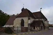
Kirche Saint-Pierre-ès-Liens
- Kirche Saint-Pierre-ès-Liens
This article is issued from Wikipedia. The text is licensed under Creative Commons - Attribution - Sharealike. The authors of the article are listed here. Additional terms may apply for the media files, click on images to show image meta data.