Saint-Étienne-sous-Barbuise
Saint-Étienne-sous-Barbuise ist eine französische Gemeinde mit 177 Einwohnern (Stand 1. Januar 2019) im Département Aube in der Region Grand Est; sie gehört zum Arrondissement Troyes und zum Kanton Arcis-sur-Aube.
| Saint-Étienne-sous-Barbuise | ||
|---|---|---|
| ||
| Staat | Frankreich | |
| Region | Grand Est | |
| Département (Nr.) | Aube (10) | |
| Arrondissement | Troyes | |
| Kanton | Arcis-sur-Aube | |
| Gemeindeverband | Arcis, Mailly, Ramerupt | |
| Koordinaten | 48° 30′ N, 4° 7′ O | |
| Höhe | 98–140 m | |
| Fläche | 10,96 km² | |
| Einwohner | 177 (1. Januar 2019) | |
| Bevölkerungsdichte | 16 Einw./km² | |
| Postleitzahl | 10700 | |
| INSEE-Code | 10338 | |
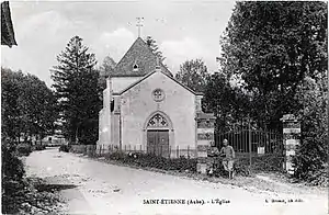 Kirche Saint-Étienne (Aufnahme von 1910) | ||

Geografie
Die Gemeinde liegt auf halber Strecke zwischen Paris und Nancy nahe der Autoroute A26.
Bevölkerungsentwicklung
| Jahr | 1962 | 1968 | 1975 | 1982 | 1990 | 1999 | 2008 | 2016 |
| Einwohner | 129 | 154 | 144 | 147 | 117 | 118 | 130 | 161 |
This article is issued from Wikipedia. The text is licensed under Creative Commons - Attribution - Sharealike. The authors of the article are listed here. Additional terms may apply for the media files, click on images to show image meta data.