Villeneuve-au-Chemin
Villeneuve-au-Chemin ist eine französische Gemeinde mit 184 Einwohnern (Stand: 1. Januar 2019) im Département Aube in der Region Grand Est (vor 2016 Champagne-Ardenne). Sie gehört zum Kanton Aix-en-Othe im Arrondissement Troyes.
| Villeneuve-au-Chemin | ||
|---|---|---|
| ||
| Staat | Frankreich | |
| Region | Grand Est | |
| Département (Nr.) | Aube (10) | |
| Arrondissement | Troyes | |
| Kanton | Aix-en-Othe | |
| Gemeindeverband | Chaourçois et du Val d’Armance | |
| Koordinaten | 48° 5′ N, 3° 51′ O | |
| Höhe | 135–270 m | |
| Fläche | 3,39 km² | |
| Einwohner | 184 (1. Januar 2019) | |
| Bevölkerungsdichte | 54 Einw./km² | |
| Postleitzahl | 10130 | |
| INSEE-Code | 10422 | |
| Website | http://www.villeneuve-au-chemin.fr/ | |

Geographie
Villeneuve-au-Chemin liegt etwa 26 Kilometer südwestlich von Troyes. Nachbargemeinden sind Vosnon im Norden, Montfey im Osten und Südosten sowie Coursan-en-Othe im Süden und Westen.
Durch die Gemeinde führt die Route nationale 77.
Bevölkerungsentwicklung
| Jahr | 1962 | 1968 | 1975 | 1982 | 1990 | 1999 | 2006 | 2011 | 2016 |
|---|---|---|---|---|---|---|---|---|---|
| Einwohner | 209 | 238 | 218 | 186 | 167 | 176 | 198 | 180 | 186 |
| Quelle: Cassini und INSEE | |||||||||
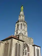
Sehenswürdigkeiten
- Kirche Saint-Jean-Baptiste
- Kapelle Saint-Joseph-des-Anges
Kapelle Saint-Joseph-des-Anges
This article is issued from Wikipedia. The text is licensed under Creative Commons - Attribution - Sharealike. The authors of the article are listed here. Additional terms may apply for the media files, click on images to show image meta data.