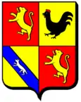
Waldweistroff
| Waldweistroff | ||
|---|---|---|
|
| |
| Staat | Frankreich | |
| Region | Grand Est | |
| Département (Nr.) | Moselle (57) | |
| Arrondissement | Thionville | |
| Kanton | Bouzonville | |
| Gemeindeverband | Bouzonvillois-Trois Frontières | |
| Koordinaten | 49° 22′ N, 6° 30′ O | |
| Höhe | 224–291 m | |
| Fläche | 7,80 km² | |
| Einwohner | 504 (1. Januar 2019) | |
| Bevölkerungsdichte | 65 Einw./km² | |
| Postleitzahl | 57320 | |
| INSEE-Code | 57739 | |
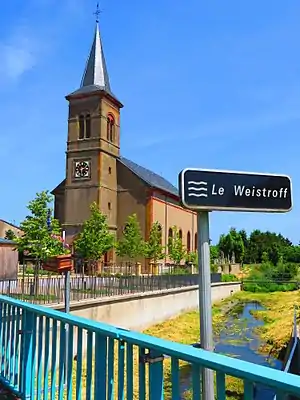 Kirche Saint-Hubert | ||

Waldweistroff (deutsch Waldweisdorf, lothringisch Waldweischtroff) ist eine französische Gemeinde mit 504 Einwohnern (Stand 1. Januar 2019) im Département Moselle in der Region Grand Est (bis 2015 Lothringen). Sie gehört zum Arrondissement Thionville.
Geografie
Waldweistroff liegt etwa 24 Kilometer östlich von Thionville nahe der deutschen Grenze auf einer Höhe zwischen 224 und 291 m über dem Meeresspiegel, die mittlere Höhe beträgt 240 m. Das Gemeindegebiet umfasst 7,73 km².
Geschichte
Der Ort gehört seit 1661 zu Frankreich.
Bevölkerungsentwicklung
| Jahr | 1962 | 1968 | 1975 | 1982 | 1990 | 1999 | 2007 | 2015 |
| Einwohner | 378 | 381 | 402 | 437 | 405 | 411 | 406 | 494 |
Verkehr
Waldweistroff lag an der mittlerweile stillgelegten Bahnstrecke Merzig–Bettelainville.
This article is issued from Wikipedia. The text is licensed under Creative Commons - Attribution - Sharealike. The authors of the article are listed here. Additional terms may apply for the media files, click on images to show image meta data.