Lizio
Lizio (Gallo Lizio, bretonisch Lizioù) ist eine französische Gemeinde mit 736 Einwohnern (Stand 1. Januar 2019) im Département Morbihan in der Region Bretagne.
| Lizio Lizioù | ||
|---|---|---|
.svg.png.webp)
|
| |
| Staat | Frankreich | |
| Region | Bretagne | |
| Département (Nr.) | Morbihan (56) | |
| Arrondissement | Vannes | |
| Kanton | Moréac | |
| Gemeindeverband | De l’Oust à Brocéliande Communauté | |
| Koordinaten | 47° 52′ N, 2° 32′ W | |
| Höhe | 42–163 m | |
| Fläche | 16,85 km² | |
| Einwohner | 736 (1. Januar 2019) | |
| Bevölkerungsdichte | 44 Einw./km² | |
| Postleitzahl | 56460 | |
| INSEE-Code | 56112 | |
| Website | http://www.lizio.fr/ | |
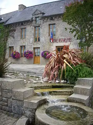 das Rathaus (Mairie) von Lizio | ||

Geografie
Lizio liegt rund 29 Kilometer nordöstlich von Vannes im Osten des Départements Morbihan. Nachbargemeinden sind
- Saint-Servant im Norden,
- Val d’Oust mit Quily im Nordosten und Le Roc-Saint-André im Südosten,
- Sérent im Süden,
- Plumelec im Südwesten,
- Cruguel im Nordwesten.
Bevölkerungsentwicklung
| 1793 | 1846 | 1901 | 1962 | 1968 | 1975 | 1982 | 1990 | 1999 | 2006 | 2012 | ||
|---|---|---|---|---|---|---|---|---|---|---|---|---|
| 850 | 1209 | 1134 | 816 | 801 | 766 | 722 | 747 | 737 | 679 | 730 | ||
| Quellen: Cassini und INSEE | ||||||||||||
.JPG.webp) die Kapelle Sainte-Catherine
die Kapelle Sainte-Catherine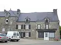 alte Häuser im Dorfzentrum
 Die Dorfkirche Notre-Dame-du-Lys
.JPG.webp) Öffentlicher Waschplatz mit der Quelle Saint-Lubin im Hintergrund
Öffentlicher Waschplatz mit der Quelle Saint-Lubin im Hintergrund
Sehenswürdigkeiten
Literatur
- Le Patrimoine des Communes du Morbihan. Flohic Editions, Band 2, Paris 1996, ISBN 2-84234-009-4, S. 557–559.
Weblinks
Commons: Lizio – Sammlung von Bildern, Videos und Audiodateien
This article is issued from Wikipedia. The text is licensed under Creative Commons - Attribution - Sharealike. The authors of the article are listed here. Additional terms may apply for the media files, click on images to show image meta data.