Bohal
Bohal (Gallo Bohau, bretonisch Bohal) ist eine französische Gemeinde mit 855 Einwohnern (Stand 1. Januar 2019) im Département Morbihan in der Region Bretagne.
| Bohal Bohau | ||
|---|---|---|
.svg.png.webp)
|
| |
| Staat | Frankreich | |
| Region | Bretagne | |
| Département (Nr.) | Morbihan (56) | |
| Arrondissement | Vannes | |
| Kanton | Moréac | |
| Gemeindeverband | De l’Oust à Brocéliande Communauté | |
| Koordinaten | 47° 47′ N, 2° 26′ W | |
| Höhe | 17–90 m | |
| Fläche | 8,47 km² | |
| Einwohner | 855 (1. Januar 2019) | |
| Bevölkerungsdichte | 101 Einw./km² | |
| Postleitzahl | 56140 | |
| INSEE-Code | 56020 | |
| Website | http://www.bohal.fr/ | |
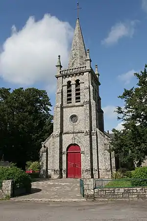 Dorfkirche Saint-Gildas in Bohal | ||

Geografie
Bohal liegt rund 28 Kilometer nordöstlich von Vannes im Osten des Départements Morbihan. Nachbargemeinden sind Sérent im Nordwesten und Norden, Saint-Marcel im Nordosten und Osten, Pleucadeuc im Südosten und Süden, Molac im Südwesten sowie Saint-Guyomard im Südwesten und Westen.
Die Allée couverte von Trébiguet liegt an einem Hang mit Blick auf den Fluss La Claie, bei Bohal.
Bevölkerungsentwicklung
| 1793 | 1906 | 1962 | 1968 | 1975 | 1982 | 1990 | 1999 | 2006 | 2012 | ||
|---|---|---|---|---|---|---|---|---|---|---|---|
| 290 | 483 | 387 | 360 | 349 | 344 | 457 | 501 | 697 | 803 | ||
| Quellen: Cassini und INSEE | |||||||||||
Literatur
- Le Patrimoine des Communes du Morbihan. Flohic Editions, Band 2, Paris 1996, ISBN 2-84234-009-4, S. 551–552.
Weblinks
Commons: Bohal – Sammlung von Bildern, Videos und Audiodateien
This article is issued from Wikipedia. The text is licensed under Creative Commons - Attribution - Sharealike. The authors of the article are listed here. Additional terms may apply for the media files, click on images to show image meta data.