Prunières (Hautes-Alpes)
Prunières ist eine französische Gemeinde im Département Hautes-Alpes in der Region Provence-Alpes-Côte d’Azur. Sie gehört zum Kanton Chorges im Arrondissement Gap.
| Prunières | ||
|---|---|---|

|
| |
| Staat | Frankreich | |
| Region | Provence-Alpes-Côte d’Azur | |
| Département (Nr.) | Hautes-Alpes (05) | |
| Arrondissement | Gap | |
| Kanton | Chorges | |
| Gemeindeverband | Serre-Ponçon | |
| Koordinaten | 44° 33′ N, 6° 20′ O | |
| Höhe | 770–2390 m | |
| Fläche | 15,24 km² | |
| Einwohner | 299 (1. Januar 2019) | |
| Bevölkerungsdichte | 20 Einw./km² | |
| Postleitzahl | 05230 | |
| INSEE-Code | 05106 | |
 Prunières | ||
Geografie
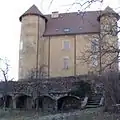
Prunières liegt am Nordufer des Lac de Serre-Ponçon, gegenüber von Pontis. Die weiteren Nachbargemeinden sind Réallon im Norden, Saint-Apollinaire und Savines-le-Lac im Osten sowie Chorges im Westen. Im Ortsteil Les Clots befindet sich die Mairie. Außerdem gehören die Weiler Pra Périer, Verièr (Standort des Schlosses), Les Vignes, Le Lauguet und Champioga an der Route nationale 94 zu Prunières.
Bevölkerungsentwicklung
| Jahr | 1962 | 1968 | 1975 | 1982 | 1990 | 1999 | 2008 | 2012 |
|---|---|---|---|---|---|---|---|---|
| Einwohner | 154 | 154 | 121 | 138 | 175 | 232 | 289 | 294 |
 Kapelle Saint-Michel am Stausee Lac de Serre-Ponçon bei Niedrigwasser
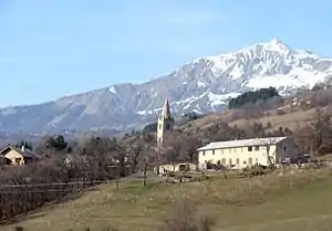
 Kirche Saint-Sauveur
 Schloss
This article is issued from Wikipedia. The text is licensed under Creative Commons - Attribution - Sharealike. The authors of the article are listed here. Additional terms may apply for the media files, click on images to show image meta data.
