Sigottier
Sigottier ist eine französische Gemeinde im Département Hautes-Alpes in der Region Provence-Alpes-Côte d’Azur. Sie gehört zum Arrondissement Gap und zum Kanton Serres.
| Sigottier | ||
|---|---|---|
| ||
| Staat | Frankreich | |
| Region | Provence-Alpes-Côte d’Azur | |
| Département (Nr.) | Hautes-Alpes (05) | |
| Arrondissement | Gap | |
| Kanton | Serres | |
| Gemeindeverband | Sisteronais-Buëch | |
| Koordinaten | 44° 27′ N, 5° 42′ O | |
| Höhe | 672–1634 m | |
| Fläche | 25,41 km² | |
| Einwohner | 87 (1. Januar 2019) | |
| Bevölkerungsdichte | 3 Einw./km² | |
| Postleitzahl | 05700 | |
| INSEE-Code | 05167 | |
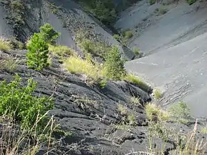 Landschaft bei Sigottier | ||

Geographie
Die Gemeinde liegt in den Seealpen und grenzt im Norden an La Piarre und Aspremont, im Osten an La Bâtie-Montsaléon, im Süden an Serres und Montclus sowie im Westen an L’Épine.
Bevölkerungsentwicklung
| Jahr | 1962 | 1968 | 1975 | 1982 | 1990 | 1999 | 2008 | 2012 |
|---|---|---|---|---|---|---|---|---|
| Einwohner | 81 | 81 | 66 | 57 | 69 | 74 | 69 | 83 |
This article is issued from Wikipedia. The text is licensed under Creative Commons - Attribution - Sharealike. The authors of the article are listed here. Additional terms may apply for the media files, click on images to show image meta data.