Pontis
Pontis ist eine französische Gemeinde mit 92 Einwohnern (Stand 1. Januar 2019) im Département Alpes-de-Haute-Provence in der Region Provence-Alpes-Côte d’Azur. Sie gehört zum Kanton Barcelonnette im Arrondissement Barcelonnette.
| Pontis | ||
|---|---|---|

|
| |
| Staat | Frankreich | |
| Region | Provence-Alpes-Côte d’Azur | |
| Département (Nr.) | Alpes-de-Haute-Provence (04) | |
| Arrondissement | Barcelonnette | |
| Kanton | Barcelonnette | |
| Gemeindeverband | Serre-Ponçon | |
| Koordinaten | 44° 30′ N, 6° 22′ O | |
| Höhe | 771–2320 m | |
| Fläche | 16,08 km² | |
| Einwohner | 92 (1. Januar 2019) | |
| Bevölkerungsdichte | 6 Einw./km² | |
| Postleitzahl | 05160 | |
| INSEE-Code | 04154 | |
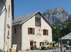
 Mairie Pontis | ||
Geografie
Pontis liegt am Stausee Lac de Serre-Ponçon, der von der Durance durchflossen wird. Gegenüber liegen die Gemeinden Chorges und Prunières. Die weiteren Nachbargemeinden sind Savines-le-Lac, Crots, Le Lauzet-Ubaye und Le Sauze-du-Lac. Zur Gemeindegemarkung gehören neben der Hauptsiedlung auch die Weiler L’Androis de Pontis, Les Hugues, Les Chappas, Fontbelle/Antelme, Les Notaires, Les Chevalliers, Les Sartres und L’Église. 554 Hektar sind bewaldet.
Bevölkerungsentwicklung
| Jahr | 1962 | 1968 | 1975 | 1982 | 1990 | 1999 | 2005 | 2012 |
|---|---|---|---|---|---|---|---|---|
| Einwohner | 87 | 64 | 62 | 63 | 44 | 45 | 65 | 78 |
Sehenswürdigkeiten
- Kirche Saint-Jérôme
- Kirche Saint-Claude-de-l’Androis
 Kirche Saint-Jérôme
 Kirche Saint-Claude im Ortsteil L’Androis
This article is issued from Wikipedia. The text is licensed under Creative Commons - Attribution - Sharealike. The authors of the article are listed here. Additional terms may apply for the media files, click on images to show image meta data.
