Méreuil
Méreuil ist eine französische Gemeinde im Département Hautes-Alpes in der Region Provence-Alpes-Côte d’Azur. Sie gehört zum Kanton Serres im Arrondissement Gap.
| Méreuil | ||
|---|---|---|
| ||
| Staat | Frankreich | |
| Region | Provence-Alpes-Côte d’Azur | |
| Département (Nr.) | Hautes-Alpes (05) | |
| Arrondissement | Gap | |
| Kanton | Serres | |
| Gemeindeverband | Sisteronais-Buëch | |
| Koordinaten | 44° 23′ N, 5° 44′ O | |
| Höhe | 610–1546 m | |
| Fläche | 11,01 km² | |
| Einwohner | 86 (1. Januar 2019) | |
| Bevölkerungsdichte | 8 Einw./km² | |
| Postleitzahl | 05700 | |
| INSEE-Code | 05076 | |
Geografie
Im Osten bildet der Wildwasserfluss Buëch weitgehend die Grenze zu Le Bersac und Montrond. Auf der Seite von Méreuil nimmt er Bäche wie den Torrent de Primourinc und den Torrent de Rabasse auf. Die weiteren Nachbargemeinden sind Serres im Norden, Trescléoux im Süden, Chanousse im Südwesten und Montclus im Nordwesten.
Bevölkerungsentwicklung
| Jahr | 1962 | 1968 | 1975 | 1982 | 1990 | 1999 | 2008 | 2012 |
|---|---|---|---|---|---|---|---|---|
| Einwohner | 93 | 95 | 80 | 83 | 104 | 78 | 85 | 88 |
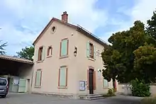
 Rathaus- und Schulgebäude |
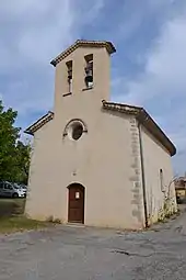
 Kirche Saint-Firmin |
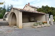
 Lavoir Méreuil |
This article is issued from Wikipedia. The text is licensed under Creative Commons - Attribution - Sharealike. The authors of the article are listed here. Additional terms may apply for the media files, click on images to show image meta data.
