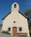
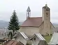
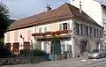
La Fare-en-Champsaur
La Fare-en-Champsaur ist eine französische Gemeinde im Département Hautes-Alpes in der Region Provence-Alpes-Côte d’Azur. Sie gehört zum Arrondissement Gap und zum Kanton Saint-Bonnet-en-Champsaur.
| La Fare-en-Champsaur | ||
|---|---|---|

|
| |
| Staat | Frankreich | |
| Region | Provence-Alpes-Côte d’Azur | |
| Département (Nr.) | Hautes-Alpes (05) | |
| Arrondissement | Gap | |
| Kanton | Saint-Bonnet-en-Champsaur | |
| Gemeindeverband | Champsaur-Valgaudemar | |
| Koordinaten | 44° 41′ N, 6° 4′ O | |
| Höhe | 949–2082 m | |
| Fläche | 10,27 km² | |
| Einwohner | 433 (1. Januar 2019) | |
| Bevölkerungsdichte | 42 Einw./km² | |
| Postleitzahl | 05500 | |
| INSEE-Code | 05054 | |

Geografie
Im Nordosten verlaufen der Fluss Drac und die Schnellstraße Route nationale 85 an der Gemeindegrenze entlang. La Fare-en-Champsaur grenzt im Nordosten an Saint-Bonnet-en-Champsaur, im Südosten an Laye, im Südwesten an Gap und im Nordwesten an Poligny.
Bevölkerungsentwicklung
| Jahr | 1962 | 1968 | 1975 | 1982 | 1990 | 1999 | 2008 | 2016 |
|---|---|---|---|---|---|---|---|---|
| Einwohner | 361 | 354 | 397 | 409 | 422 | 413 | 418 | 443 |
This article is issued from Wikipedia. The text is licensed under Creative Commons - Attribution - Sharealike. The authors of the article are listed here. Additional terms may apply for the media files, click on images to show image meta data.