Yankton County
Yankton County[1] ist ein County im Bundesstaat South Dakota der Vereinigten Staaten von Amerika.
| Verwaltung | |
|---|---|
| US-Bundesstaat: | South Dakota |
| Verwaltungssitz: | Yankton |
| Gründung: | 1862 |
| Demographie | |
| Einwohner: | 22.438 (2010) |
| Bevölkerungsdichte: | 16,62 Einwohner/km2 |
| Geographie | |
| Fläche gesamt: | 1379 km² |
| Wasserfläche: | 29 km² |
| Karte | |
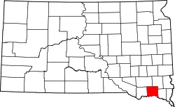 Karte von Yankton County innerhalb von South Dakota | |
Geographie
Das County hat eine Fläche von 1379 Quadratkilometern; davon sind 29 Quadratkilometer (2,08 Prozent) Wasserflächen.
Geschichte
Das County wurde am 10. April 1862 gegründet und nach dem Indianerstamm der Yankton benannt.[2]
_from_SE_2.JPG.webp)
76 Bauwerke und Stätten des Countys sind im National Register of Historic Places (NRHP) eingetragen (Stand 9. August 2018).[3]
Bevölkerungsentwicklung
| Bevölkerungsentwicklung | |||
|---|---|---|---|
| Census | Einwohner | ± in % | |
| 1900 | 12.649 | — | |
| 1910 | 13.135 | 3,8 % | |
| 1920 | 15.233 | 16 % | |
| 1930 | 16.589 | 8,9 % | |
| 1940 | 16.725 | 0,8 % | |
| 1950 | 16.804 | 0,5 % | |
| 1960 | 17.551 | 4,4 % | |
| 1970 | 19.039 | 8,5 % | |
| 1980 | 18.952 | −0,5 % | |
| 1990 | 19.252 | 1,6 % | |
| 2000 | 21.652 | 12,5 % | |
| 2010 | 22.438 | 3,6 % | |
| 1900–1990[4]
2000[5] | |||
Städte und Gemeinden
Städte (cities):
Gemeinden (towns):
- Gayville
- Lesterville
- Mission Hill
- Utica
- Valleyview
- Volin
Townships
Das County ist in neun Townships eingeteilt: Gayville, Jamesville, Marindahl, Mayfield, Mission Hill, Turkey Valley, Utica, Volin, Walshtown; und in zwei Unorganisierte Territorien: Southeast Yankton und West Yankton.
Weblinks
Einzelnachweise
- Yankton County im Geographic Names Information System des United States Geological Survey. Abgerufen am 22. Februar 2011
- Charles Curry Aiken, Joseph Nathan Kane: The American Counties: Origins of County Names, Dates of Creation, Area, and Population Data, 1950–2010. 6. Auflage. Scarecrow Press, Lanham 2013, ISBN 978-0-8108-8762-6, S. 337.
- Suchmaske Datenbank im National Register Information System. National Park Service, abgerufen am 9. August 2018.
- Auszug aus Census.gov. Abgerufen am 28. Februar 2011
- Auszug aus factfinder.census.gov Abgerufen am 28. Februar 2011
Liste der Countys in South Dakota
Aurora |
Beadle |
Bennett |
Bon Homme |
Brookings |
Brown |
Brule |
Buffalo |
Butte |
Campbell |
Charles Mix |
Clark |
Clay |
Codington |
Corson |
Custer |
Davison |
Day |
Deuel |
Dewey |
Douglas |
Edmunds |
Fall River |
Faulk |
Grant |
Gregory |
Haakon |
Hamlin |
Hand |
Hanson |
Harding |
Hughes |
Hutchinson |
Hyde |
Jackson |
Jerauld |
Jones |
Kingsbury |
Lake |
Lawrence |
Lincoln |
Lyman |
Marshall |
McCook |
McPherson |
Meade |
Mellette |
Miner |
Minnehaha |
Moody |
Oglala Lakota |
Pennington |
Perkins |
Potter |
Roberts |
Sanborn |
Spink |
Stanley |
Sully |
Todd |
Tripp |
Turner |
Union |
Walworth |
Yankton |
Ziebach