Clark County (South Dakota)
Clark County[1] ist ein Bezirk im Bundesstaat South Dakota der Vereinigten Staaten. Es hat 4.143 Einwohner. Der Verwaltungssitz (County Seat) ist Clark.
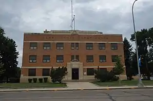 Clark County Courthouse | |
| Verwaltung | |
|---|---|
| US-Bundesstaat: | South Dakota |
| Verwaltungssitz: | Clark |
| Gründung: | 1873 |
| Demographie | |
| Einwohner: | 3691 (2010) |
| Bevölkerungsdichte: | 1,49 Einwohner/km2 |
| Geographie | |
| Fläche gesamt: | 2507 km² |
| Wasserfläche: | 26 km² |
| Karte | |
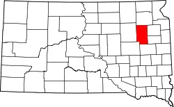 Karte von Clark County innerhalb von South Dakota | |
Geographie
Das County hat eine Fläche von 2507 Quadratkilometern; davon sind 26 Quadratkilometer (1,02 Prozent) Wasserflächen.
Geschichte
Das County wurde am 18. Januar 1873 gegründet und die Verwaltung am 2. Mai 1881 abschließend organisiert. Es wurde nach Newton Clark benannt, dem ersten Schullehrer in Sioux Falls und Abgeordneten in der gesetzgebenden Versammlung des Dakota-Territoriums.[2]

Neun Bauwerke und Stätten des Countys sind im National Register of Historic Places (NRHP) eingetragen (Stand 30. Juli 2018).[3]
Bevölkerungsentwicklung
| Bevölkerungsentwicklung | |||
|---|---|---|---|
| Census | Einwohner | ± in % | |
| 1900 | 6942 | — | |
| 1910 | 10.901 | 57 % | |
| 1920 | 11.136 | 2,2 % | |
| 1930 | 11.022 | −1 % | |
| 1940 | 8955 | −18,8 % | |
| 1950 | 8369 | −6,5 % | |
| 1960 | 7134 | −14,8 % | |
| 1970 | 5515 | −22,7 % | |
| 1980 | 4894 | −11,3 % | |
| 1990 | 4403 | −10 % | |
| 2000 | 4143 | −5,9 % | |
| 2010 | 3691 | −10,9 % | |
| 1900–1990[4]
2000[5] | |||
Städte und Gemeinden
Städte (cities)
- Clark
- Naples
- Willow Lake
Gemeinden (towns)
- Vienna
- Raymond
- Garden City
- Bradley
Gemeindefreie Gebiete
- Elrod
- Crocker
- Carpenter
Townships
Das County ist in 27 Townships eingeteilt: Ash, Blaine, Collins, Cottonwood, Darlington, Day, Eden, Elrod, Fordham, Foxton, Garfield, Hague, Lake, Lincoln, Logan, Maydell, Merton, Mount Pleasant, Pleasant, Raymond, Richland, Rosedale, Spring Valley, Thorp, Warren, Washington und Woodland.
Weblinks
Einzelnachweise
- Clark County im Geographic Names Information System des United States Geological Survey. Abgerufen am 22. Februar 2011
- Charles Curry Aiken, Joseph Nathan Kane: The American Counties: Origins of County Names, Dates of Creation, Area, and Population Data, 1950–2010. 6. Auflage. Scarecrow Press, Lanham 2013, ISBN 978-0-8108-8762-6, S. 59.
- Suchmaske Datenbank im National Register Information System. National Park Service, abgerufen am 30. Juli 2018.
- Auszug aus Census.gov. Abgerufen am 28. Februar 2011
- Auszug aus factfinder.census.gov Abgerufen am 28. Februar 2011
Liste der Countys in South Dakota
Aurora |
Beadle |
Bennett |
Bon Homme |
Brookings |
Brown |
Brule |
Buffalo |
Butte |
Campbell |
Charles Mix |
Clark |
Clay |
Codington |
Corson |
Custer |
Davison |
Day |
Deuel |
Dewey |
Douglas |
Edmunds |
Fall River |
Faulk |
Grant |
Gregory |
Haakon |
Hamlin |
Hand |
Hanson |
Harding |
Hughes |
Hutchinson |
Hyde |
Jackson |
Jerauld |
Jones |
Kingsbury |
Lake |
Lawrence |
Lincoln |
Lyman |
Marshall |
McCook |
McPherson |
Meade |
Mellette |
Miner |
Minnehaha |
Moody |
Oglala Lakota |
Pennington |
Perkins |
Potter |
Roberts |
Sanborn |
Spink |
Stanley |
Sully |
Todd |
Tripp |
Turner |
Union |
Walworth |
Yankton |
Ziebach