Lyman County
Lyman County[1] ist ein County im Bundesstaat South Dakota der Vereinigten Staaten. Es hat 3895 Einwohner. Der Sitz der Countyverwaltung (County Seat) ist in Kennebec.
| Verwaltung | |
|---|---|
| US-Bundesstaat: | South Dakota |
| Verwaltungssitz: | Kennebec |
| Gründung: | 1873 |
| Demographie | |
| Einwohner: | 3755 (2010) |
| Bevölkerungsdichte: | 0,88 Einwohner/km2 |
| Geographie | |
| Fläche gesamt: | 4421 km² |
| Wasserfläche: | 174 km² |
| Karte | |
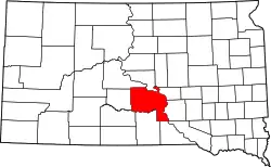 Karte von Lyman County innerhalb von South Dakota | |
Geographie
Das County hat eine Fläche von 4421 Quadratkilometern; davon sind 174 Quadratkilometer (3,93 Prozent) Wasserflächen. Er wird in 17 Townships eingeteilt: Bailey, Butte, Dorman, Fairland, Iona, Morningside, Oacoma, Pleasant, Pratt, Reliance, Rex, Rose, Rowe, Sioux und Stony Butte; sowie sechs unorganisierte Territorien: Black Dog, Lafayette, Lower Brule, McClure, Northwest Lyman und South Lyman.
Geschichte
Das County wurde am 8. Januar 1873 gegründet und die Verwaltungsorganisation am 21. Mai 1893 abgeschlossen. Es wurde nach William P. Lyman (1833–1880) benannt, einem frühen Siedler, Militär und Abgeordneten in der gesetzgebenden Versammlung des Dakota-Territoriums.[2]
Ein Ort im County hat den Status einer National Historic Landmark, die Langdeau Site.[3] Acht Bauwerke und Stätten des Countys sind im National Register of Historic Places (NRHP) eingetragen (Stand 2. August 2018).[4]
Bevölkerungsentwicklung
| Bevölkerungsentwicklung | |||
|---|---|---|---|
| Census | Einwohner | ± in % | |
| 1900 | 2632 | — | |
| 1910 | 10.848 | 312,2 % | |
| 1920 | 6591 | −39,2 % | |
| 1930 | 6335 | −3,9 % | |
| 1940 | 5045 | −20,4 % | |
| 1950 | 4572 | −9,4 % | |
| 1960 | 4428 | −3,1 % | |
| 1970 | 4060 | −8,3 % | |
| 1980 | 3864 | −4,8 % | |
| 1990 | 3638 | −5,8 % | |
| 2000 | 3895 | 7,1 % | |
| 2010 | 3755 | −3,6 % | |
| 1900–1990[5]
2000[6] | |||
Städte und Gemeinden
Städte (cities)
- Presho
Gemeinden (towns)
- Kennebec
- Oacoma
- Reliance
- Lower Brule
- Vivian
Gemeindefreies Gebiet (unincorporated communities)
- Iona
Weblinks
Einzelnachweise
- Lyman County im Geographic Names Information System des United States Geological Survey. Abgerufen am 22. Februar 2011
- Charles Curry Aiken, Joseph Nathan Kane: The American Counties: Origins of County Names, Dates of Creation, Area, and Population Data, 1950–2010. 6. Auflage. Scarecrow Press, Lanham 2013, ISBN 978-0-8108-8762-6, S. 187.
- Listing of National Historic Landmarks by State: South Dakota. National Park Service, abgerufen am 2. August 2018.
- Suchmaske Datenbank im National Register Information System. National Park Service, abgerufen am 2. August 2018.
- Auszug aus Census.gov. Abgerufen am 28. Februar 2011
- Auszug aus factfinder.census.gov Abgerufen am 28. Februar 2011
Liste der Countys in South Dakota
Aurora |
Beadle |
Bennett |
Bon Homme |
Brookings |
Brown |
Brule |
Buffalo |
Butte |
Campbell |
Charles Mix |
Clark |
Clay |
Codington |
Corson |
Custer |
Davison |
Day |
Deuel |
Dewey |
Douglas |
Edmunds |
Fall River |
Faulk |
Grant |
Gregory |
Haakon |
Hamlin |
Hand |
Hanson |
Harding |
Hughes |
Hutchinson |
Hyde |
Jackson |
Jerauld |
Jones |
Kingsbury |
Lake |
Lawrence |
Lincoln |
Lyman |
Marshall |
McCook |
McPherson |
Meade |
Mellette |
Miner |
Minnehaha |
Moody |
Oglala Lakota |
Pennington |
Perkins |
Potter |
Roberts |
Sanborn |
Spink |
Stanley |
Sully |
Todd |
Tripp |
Turner |
Union |
Walworth |
Yankton |
Ziebach