Stanley County
Stanley County[1] ist ein County in South Dakota, den Vereinigten Staaten. Es ist nach dem Major General David S. Stanley der Unionsarmee benannt. Die einzige Stadt ist Fort Pierre, in der sich auch der County Seat befindet. Die Ortszeit ist UTC: +7 Stunden. Laut einer offiziellen Schätzung des United States Census Bureau vom 1. Juli 2006 hatte das County eine Einwohnerzahl von 2815.[2] Der Sitz der Countyverwaltung (County Seat) ist in Fort Pierre.
| Verwaltung | |
|---|---|
| US-Bundesstaat: | South Dakota |
| Verwaltungssitz: | Fort Pierre |
| Adresse des Verwaltungssitzes: |
Stanley County Courthouse
08 E 2nd Avenue Fort Pierre, SD 57532 |
| Gründung: | 1873 |
| Demographie | |
| Einwohner: | 2966 (2010) |
| Bevölkerungsdichte: | 0,79 Einwohner/km2 |
| Geographie | |
| Fläche gesamt: | 3929 km² |
| Wasserfläche: | 191 km² |
| Karte | |
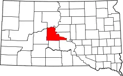 Karte von Stanley County innerhalb von South Dakota | |
| Website: www.stanleycounty.org | |
Geschichte
Zwei Orte im County haben den Status einer National Historic Landmark, das Fort Pierre Chouteau und die Verendrye Site.[3] Zwölf Bauwerke und Stätten des Countys sind im National Register of Historic Places (NRHP) eingetragen (Stand 9. August 2018).[4]
Bevölkerungsentwicklung
| Bevölkerungsentwicklung | |||
|---|---|---|---|
| Census | Einwohner | ± in % | |
| 1900 | 1341 | — | |
| 1910 | 14.975 | 1.016,7 % | |
| 1920 | 2908 | −80,6 % | |
| 1930 | 2381 | −18,1 % | |
| 1940 | 1959 | −17,7 % | |
| 1950 | 2055 | 4,9 % | |
| 1960 | 4085 | 98,8 % | |
| 1970 | 2457 | −39,9 % | |
| 1980 | 2533 | 3,1 % | |
| 1990 | 2453 | −3,2 % | |
| 2000 | 2772 | 13 % | |
| 2010 | 2966 | 7 % | |
| 1900–1990[5]
2000[6] | |||
Altersstruktur
| Bevölkerung | Jahre | Anteil |
|---|---|---|
| unter | 18 | 27,1 % |
| von | 18 – 24 | 7,1 % |
| von | 25 – 44 | 28,2 % |
| von | 45 – 64 | 26,6 % |
| über | 65 | 11,0 % |
Geographie
Der Bezirk hat eine Fläche von 3929 Quadratkilometern; davon sind 191 Quadratkilometer (4,86 Prozent) Wasserflächen. Die angrenzenden Countys im Uhrzeigersinn sind: Dewey County, Sully County, Hughes County, Lyman County, Jones County und Haakon County.
Hauptstraßen
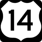 U.S. Highway 14
 U.S. Highway 83
 South Dakota State Route 34
 South Dakota State Route 63
 South Dakota State Route 1806
Weblinks
Einzelnachweise
- Stanley County im Geographic Names Information System des United States Geological Survey. Abgerufen am 22. Februar 2011
- http://www.census.gov/ Die Einwohnerzahlen sind laut dem United States Census Bureau nur geschätzt. Sie basieren nicht auf einer Zählung.
- Listing of National Historic Landmarks by State: South Dakota. National Park Service, abgerufen am 9. August 2018.
- Suchmaske Datenbank im National Register Information System. National Park Service, abgerufen am 9. August 2018.
- Auszug aus Census.gov. Abgerufen am 28. Februar 2011
- Auszug aus factfinder.census.gov Abgerufen am 28. Februar 2011
Liste der Countys in South Dakota
Aurora |
Beadle |
Bennett |
Bon Homme |
Brookings |
Brown |
Brule |
Buffalo |
Butte |
Campbell |
Charles Mix |
Clark |
Clay |
Codington |
Corson |
Custer |
Davison |
Day |
Deuel |
Dewey |
Douglas |
Edmunds |
Fall River |
Faulk |
Grant |
Gregory |
Haakon |
Hamlin |
Hand |
Hanson |
Harding |
Hughes |
Hutchinson |
Hyde |
Jackson |
Jerauld |
Jones |
Kingsbury |
Lake |
Lawrence |
Lincoln |
Lyman |
Marshall |
McCook |
McPherson |
Meade |
Mellette |
Miner |
Minnehaha |
Moody |
Oglala Lakota |
Pennington |
Perkins |
Potter |
Roberts |
Sanborn |
Spink |
Stanley |
Sully |
Todd |
Tripp |
Turner |
Union |
Walworth |
Yankton |
Ziebach