Hand County
Hand County[1] ist ein County im Bundesstaat South Dakota der Vereinigten Staaten.
| Verwaltung | |
|---|---|
| US-Bundesstaat: | South Dakota |
| Verwaltungssitz: | Miller |
| Gründung: | 1873 |
| Demographie | |
| Einwohner: | 3431 (2010) |
| Bevölkerungsdichte: | 2,4 Einwohner/km2 |
| Geographie | |
| Fläche gesamt: | 1440 km² |
| Wasserfläche: | 9 km² |
| Karte | |
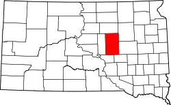 Karte von Hand County innerhalb von South Dakota | |
Geographie
Der Bezirk hat eine Fläche von 1440 Quadratkilometern; davon sind 9 Quadratkilometer (0,25 Prozent) Wasserflächen. Er ist in 40 Townships eingeteilt: Alden, Alpha, Bates, Burdette, Campbell, Carlton, Cedar, Como, Florence, Gilbert, Glendale, Grand, Greenleaf, Hiland, Holden, Hulbert, Linn, Logan, Midland, Miller, Mondamin, Ohio, Ontario, Park, Pearl, Plato, Pleasant Valley, Ree Heights, Riverside, Rockdale, Rose Hill, St. Lawrence, Spring Hill, Spring Lake, Wheaton und York; sowie ein unorganisiertes Territorium: Northwest Hand.
Geschichte
Das County wurde am 8. Januar 1873 gebildet und die Verwaltungsorganisation am 1. September 1882 abgeschlossen. Benannt wurde es nach George H. Hand (1837–1891), der United States Attorney des Dakota-Territoriums war.[2]
Sechs Bauwerke und Stätten des Countys sind insgesamt im National Register of Historic Places (NRHP) eingetragen (Stand 1. August 2018).[3]
Bevölkerungsentwicklung
| Bevölkerungsentwicklung | |||
|---|---|---|---|
| Census | Einwohner | ± in % | |
| 1900 | 4525 | — | |
| 1910 | 7870 | 73,9 % | |
| 1920 | 8778 | 11,5 % | |
| 1930 | 9485 | 8,1 % | |
| 1940 | 7166 | −24,4 % | |
| 1950 | 7149 | −0,2 % | |
| 1960 | 6712 | −6,1 % | |
| 1970 | 5883 | −12,4 % | |
| 1980 | 4948 | −15,9 % | |
| 1990 | 4272 | −13,7 % | |
| 2000 | 3741 | −12,4 % | |
| 2010 | 3431 | −8,3 % | |
| 1900–1990[4]
2000[5] | |||
Städte und Gemeinden
Städte (cities)
- Miller
Gemeinden (towns)
- Ree Heights
- St. Lawrence
Weblinks
Einzelnachweise
- Hand County im Geographic Names Information System des United States Geological Survey. Abgerufen am 22. Februar 2011
- Charles Curry Aiken, Joseph Nathan Kane: The American Counties: Origins of County Names, Dates of Creation, Area, and Population Data, 1950–2010. 6. Auflage. Scarecrow Press, Lanham 2013, ISBN 978-0-8108-8762-6, S. 128.
- Suchmaske Datenbank im National Register Information System. National Park Service, abgerufen am 1. August 2018.
- Auszug aus Census.gov. Abgerufen am 28. Februar 2011
- Auszug aus factfinder.census.gov Abgerufen am 28. Februar 2011
Liste der Countys in South Dakota
Aurora |
Beadle |
Bennett |
Bon Homme |
Brookings |
Brown |
Brule |
Buffalo |
Butte |
Campbell |
Charles Mix |
Clark |
Clay |
Codington |
Corson |
Custer |
Davison |
Day |
Deuel |
Dewey |
Douglas |
Edmunds |
Fall River |
Faulk |
Grant |
Gregory |
Haakon |
Hamlin |
Hand |
Hanson |
Harding |
Hughes |
Hutchinson |
Hyde |
Jackson |
Jerauld |
Jones |
Kingsbury |
Lake |
Lawrence |
Lincoln |
Lyman |
Marshall |
McCook |
McPherson |
Meade |
Mellette |
Miner |
Minnehaha |
Moody |
Oglala Lakota |
Pennington |
Perkins |
Potter |
Roberts |
Sanborn |
Spink |
Stanley |
Sully |
Todd |
Tripp |
Turner |
Union |
Walworth |
Yankton |
Ziebach