Saint-Front (Charente)
Saint-Front ist eine französische Gemeinde mit 366 Einwohnern (Stand 1. Januar 2019) im Département Charente in der Region Nouvelle-Aquitaine (vor 2016 Poitou-Charentes); sie gehört zum Arrondissement Confolens und zum Kanton Boixe-et-Manslois (bis 2015 Mansle). Die Einwohner werden Saint-Frontois genannt.
| Saint-Front | ||
|---|---|---|
| ||
| Staat | Frankreich | |
| Region | Nouvelle-Aquitaine | |
| Département (Nr.) | Charente (16) | |
| Arrondissement | Confolens | |
| Kanton | Boixe-et-Manslois | |
| Gemeindeverband | Cœur de Charente | |
| Koordinaten | 45° 54′ N, 0° 17′ O | |
| Höhe | 66–120 m | |
| Fläche | 13,20 km² | |
| Einwohner | 366 (1. Januar 2019) | |
| Bevölkerungsdichte | 28 Einw./km² | |
| Postleitzahl | 16460 | |
| INSEE-Code | 16318 | |
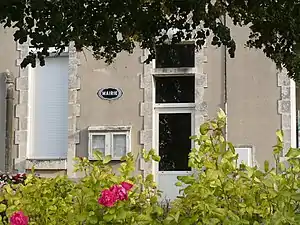 Rathaus (Mairie) von Saint-Front | ||

Geographie
Saint-Front liegt etwa 29 Kilometer nordnordöstlich von Angoulême an der Bonnieure. Umgeben wird Saint-Front von den Nachbargemeinden Couture im Norden, Ventouse im Nordosten, Valence im Osten, Val-de-Bonnieure im Süden, Saint-Ciers-sur-Bonnieure im Südwesten, Mouton im Westen sowie Aunac-sur-Charente im Nordwesten.
Bevölkerungsentwicklung
| 1962 | 1968 | 1975 | 1982 | 1990 | 1999 | 2006 | 2013 |
|---|---|---|---|---|---|---|---|
| 390 | 408 | 378 | 372 | 301 | 315 | 322 | 358 |
| Quelle: Cassini und INSEE | |||||||
Sehenswürdigkeiten

Kirche Saint-Front
- Kirche Saint-Front aus dem 12./13. Jahrhundert, seit 1956 Monument historique
Persönlichkeiten
- Henri-Théophile Bouillon (1864–1934), Bildhauer
This article is issued from Wikipedia. The text is licensed under Creative Commons - Attribution - Sharealike. The authors of the article are listed here. Additional terms may apply for the media files, click on images to show image meta data.