Les Gours
Les Gours ist eine französische Gemeinde mit 110 Einwohnern (Stand: 1. Januar 2019) im Département Charente in der Region Nouvelle-Aquitaine (vor 2016 Poitou-Charentes); sie gehört zum Arrondissement Confolens und zum Kanton Charente-Nord (bis 2015 Aigre). Die Einwohner werden Gorziens genannt.
| Les Gours | ||
|---|---|---|
| ||
| Staat | Frankreich | |
| Region | Nouvelle-Aquitaine | |
| Département (Nr.) | Charente (16) | |
| Arrondissement | Confolens | |
| Kanton | Charente-Nord | |
| Gemeindeverband | Cœur de Charente | |
| Koordinaten | 45° 58′ N, 0° 4′ W | |
| Höhe | 77–119 m | |
| Fläche | 11,44 km² | |
| Einwohner | 110 (1. Januar 2019) | |
| Bevölkerungsdichte | 10 Einw./km² | |
| Postleitzahl | 16140 | |
| INSEE-Code | 16155 | |
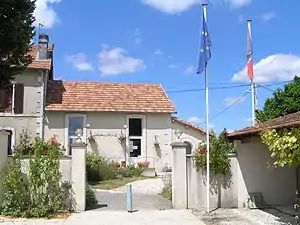 Rathaus (Mairie) von Les Gours | ||

Geographie
Les Gours liegt etwa 30 Kilometer nordnordwestlich von Angoulême am Fluss Couture und wird umgeben von den Nachbargemeinden Couture-d’Argenson im Norden, Saint-Fraigne im Osten und Südosten, Lupsault im Süden sowie Chives im Westen und Südwesten.
Bevölkerungsentwicklung
| Jahr | 1793 | 1856 | 1901 | 1962 | 1968 | 1975 | 1982 | 1990 | 1999 | 2006 | 2013 |
|---|---|---|---|---|---|---|---|---|---|---|---|
| Einwohner | 242 | 262 | 181 | 227 | 189 | 163 | 143 | 142 | 144 | 130 | 126 |
| Quelle: Cassini und INSEE | |||||||||||
Sehenswürdigkeiten
- Kirche Notre-Dame, 1778 erbaut
- Haus Les Défends, Mitte des 19. Jahrhunderts erbaut
- Haus La Plaine von 1698
- Haus La Font Brisson aus dem 16. Jahrhundert
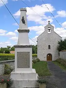
Kirche Notre-Dame
This article is issued from Wikipedia. The text is licensed under Creative Commons - Attribution - Sharealike. The authors of the article are listed here. Additional terms may apply for the media files, click on images to show image meta data.