Le Vieux-Cérier
Le Vieux-Cérier ist eine französische Gemeinde mit 127 Einwohnern (Stand: 1. Januar 2019) im Département Charente in der Region Nouvelle-Aquitaine (vor 2016 Poitou-Charentes); sie gehört zum Arrondissement Confolens und zum Kanton Charente-Bonnieure (bis 2015 Champagne-Mouton).
| Le Vieux-Cérier | ||
|---|---|---|
| ||
| Staat | Frankreich | |
| Region | Nouvelle-Aquitaine | |
| Département (Nr.) | Charente (16) | |
| Arrondissement | Confolens | |
| Kanton | Charente-Bonnieure | |
| Gemeindeverband | Charente Limousine | |
| Koordinaten | 45° 58′ N, 0° 27′ O | |
| Höhe | 141–195 m | |
| Fläche | 9,67 km² | |
| Einwohner | 127 (1. Januar 2019) | |
| Bevölkerungsdichte | 13 Einw./km² | |
| Postleitzahl | 16350 | |
| INSEE-Code | 16403 | |
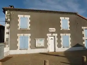 Rathaus (Mairie) von Le Vieux-Cérier | ||

Geographie
Le Vieux-Cérier liegt etwa 45 Kilometer nordnordöstlich von Angoulême. Le Vieux-Cérier wird umgeben von den Nachbargemeinden Champagne-Mouton im Norden und Westen, Saint-Coutant im Norden und Osten, Saint-Laurent-de-Céris im Südosten, Le Grand-Madieu im Süden sowie Turgon im Südwesten.
Bevölkerungsentwicklung
| Jahr | 1793 | 1856 | 1901 | 1962 | 1968 | 1975 | 1982 | 1990 | 1999 | 2006 | 2013 |
|---|---|---|---|---|---|---|---|---|---|---|---|
| Einwohner | 531 | 570 | 412 | 303 | 282 | 243 | 199 | 154 | 134 | 142 | 133 |
| Quelle: Cassini und INSEE | |||||||||||
Sehenswürdigkeiten
- Reste einer Turmhügelburg (Motte)
- Kirche Saint-Pierre-ès-Liens aus dem 15. Jahrhundert
- Turm Majusier

Kirche Saint-Pierre-ès-Liens
This article is issued from Wikipedia. The text is licensed under Creative Commons - Attribution - Sharealike. The authors of the article are listed here. Additional terms may apply for the media files, click on images to show image meta data.