Kanton Bayon
Der Kanton Bayon war bis 2015 ein französischer Wahlkreis im Arrondissement Lunéville, im Département Meurthe-et-Moselle und in der Region Lothringen; sein Hauptort war Bayon. Letzter Vertreter im Generalrat des Départements war von 2011 bis 2015 Christophe Sonrel (PCF).
| Ehemaliger Kanton Bayon | |
|---|---|
| Region | Lothringen |
| Département | Meurthe-et-Moselle |
| Arrondissement | Lunéville |
| Hauptort | Bayon |
| Auflösungsdatum | 29. März 2015 |
| Einwohner | 13.397 (1. Jan. 2012) |
| Bevölkerungsdichte | 71 Einw./km² |
| Fläche | 188.53 km² |
| Gemeinden | 27 |
| INSEE-Code | 5405 |
Der Kanton Bayon war 188,53 km² groß und hatte 12.752 Einwohner (Stand 2006). Der Kanton lag im Süden des Départements Meurthe-et-Moselle an dessen Südgrenze.
 Lage des Kantons Bayon im Département Meurthe-et-Moselle
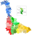
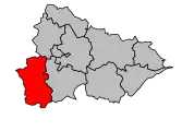 Lage des Kantons Bayon im Arrondissement Lunéville
Geschichte
Der Kanton Bayon gehörte im 19. Jahrhundert zum Département Meurthe. Nach dem Vertrag von Frankfurt 1871 blieb Bayon französisch und wurde dem neuen Kanton Meurthe-et-Moselle zugeschlagen.
Gemeinden
| Gemeinde | Einwohner Jahr | Fläche km² | Bevölkerungsdichte | Code INSEE | Postleitzahl |
|---|---|---|---|---|---|
| Barbonville | 430 (2013) | 10,81 | 40 Einw./km² | 54045 | 54360 |
| Bayon | 1.622 (2013) | 6,05 | 268 Einw./km² | 54054 | 54290 |
| Blainville-sur-l’Eau | 3.993 (2013) | 11,74 | 340 Einw./km² | 54076 | 54360 |
| Borville | 97 (2013) | 4,71 | 21 Einw./km² | 54085 | 54290 |
| Brémoncourt | 155 (2013) | 5,24 | 30 Einw./km² | 54098 | 54290 |
| Charmois | 183 (2013) | 5,41 | 34 Einw./km² | 54121 | 54360 |
| Clayeures | 197 (2013) | 9,21 | 21 Einw./km² | 54130 | 54290 |
| Damelevières | 3.161 (2013) | 8,12 | 389 Einw./km² | 54152 | 54360 |
| Domptail-en-l’Air | 70 (2013) | 3,13 | 22 Einw./km² | 54170 | 54290 |
| Einvaux | 327 (2013) | 7,38 | 44 Einw./km² | 54175 | 54360 |
| Froville | 123 (2013) | 5,89 | 21 Einw./km² | 54216 | 54290 |
| Haigneville | 52 (2013) | 2,85 | 18 Einw./km² | 54245 | 54290 |
| Haussonville | 307 (2013) | 11,18 | 27 Einw./km² | 54256 | 54290 |
| Landécourt | 102 (2013) | 5,82 | 18 Einw./km² | 54293 | 54360 |
| Lorey | 113 (2013) | 5,18 | 22 Einw./km² | 54324 | 54290 |
| Loromontzey | 83 (2013) | 7,68 | 11 Einw./km² | 54325 | 54290 |
| Méhoncourt | 241 (2013) | 7,87 | 31 Einw./km² | 54359 | 54360 |
| Romain | 68 (2013) | 3,15 | 22 Einw./km² | 54461 | 54360 |
| Rozelieures | 192 (2013) | 9,38 | 20 Einw./km² | 54467 | 54290 |
| Saint-Boingt | 74 (2013) | 8,14 | 9 Einw./km² | 54471 | 54290 |
| Saint-Germain | 157 (2013) | 7,68 | 20 Einw./km² | 54475 | 54290 |
| Saint-Mard | 95 (2013) | 2,95 | 32 Einw./km² | 54479 | 54290 |
| Saint-Rémy-aux-Bois | 78 (2013) | 9,76 | 8 Einw./km² | 54487 | 54290 |
| Velle-sur-Moselle | 296 (2013) | 4,47 | 66 Einw./km² | 54559 | 54290 |
| Vigneulles | 243 (2013) | 5,57 | 44 Einw./km² | 54565 | 54360 |
| Villacourt | 429 (2013) | 14,1 | 30 Einw./km² | 54567 | 54290 |
| Virecourt | 466 (2013) | 5,06 | 92 Einw./km² | 54585 | 54290 |
Bevölkerungsentwicklung
| 1962 | 1968 | 1975 | 1982 | 1990 | 1999 | 2006 | 2012 |
|---|---|---|---|---|---|---|---|
| 11.971 | 12.957 | 12.376 | 12.173 | 11.931 | 12.063 | 12.752 | 13.397 |
This article is issued from Wikipedia. The text is licensed under Creative Commons - Attribution - Sharealike. The authors of the article are listed here. Additional terms may apply for the media files, click on images to show image meta data.