Garnerans
Garnerans ist eine französische Gemeinde mit 634 Einwohnern (Stand 1. Januar 2019) im Département Ain in der Region Auvergne-Rhône-Alpes. Sie gehört zum Kanton Châtillon-sur-Chalaronne im Arrondissement Bourg-en-Bresse.
| Garnerans | ||
|---|---|---|
| ||
| Staat | Frankreich | |
| Region | Auvergne-Rhône-Alpes | |
| Département (Nr.) | Ain (01) | |
| Arrondissement | Bourg-en-Bresse | |
| Kanton | Châtillon-sur-Chalaronne | |
| Gemeindeverband | Val de Saône Centre | |
| Koordinaten | 46° 12′ N, 4° 50′ O | |
| Höhe | 168–215 m | |
| Fläche | 8,62 km² | |
| Einwohner | 634 (1. Januar 2019) | |
| Bevölkerungsdichte | 74 Einw./km² | |
| Postleitzahl | 01140 | |
| INSEE-Code | 01167 | |
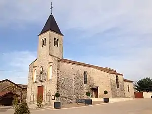 Johannes-der-Täufer-Kirche in Gamerans | ||

Geografie
Die Gemeinde Garnerans liegt nahe dem linken Ufer der Saône, etwa zwölf Kilometer südlich von Mâcon.
Bevölkerungsentwicklung
| Jahr | 1962 | 1968 | 1975 | 1982 | 1990 | 1999 | 2006 | 2011 |
| Einwohner | 394 | 350 | 335 | 376 | 484 | 565 | 623 | 660 |
| Quellen: Cassini und INSEE | ||||||||
Sehenswürdigkeiten
- Burgruine
- Kirche Saint-Jean-Baptiste
- Schloss Romans und Schloss Montgone, beide 17. Jahrhundert
Weblinks
Commons: Garnerans – Sammlung von Bildern, Videos und Audiodateien
This article is issued from Wikipedia. The text is licensed under Creative Commons - Attribution - Sharealike. The authors of the article are listed here. Additional terms may apply for the media files, click on images to show image meta data.