Dompierre-sur-Chalaronne
Dompierre-sur-Chalaronne ist eine französische Gemeinde mit 436 Einwohnern (Stand 1. Januar 2019) im Département Ain in der Region Auvergne-Rhône-Alpes. Sie gehört zum Kanton Châtillon-sur-Chalaronne im Arrondissement Bourg-en-Bresse. Sie grenzt an Saint-Étienne-sur-Chalaronne, L’Abergement-Clémenciat und Baneins.
| Dompierre-sur-Chalaronne | ||
|---|---|---|
| ||
| Staat | Frankreich | |
| Region | Auvergne-Rhône-Alpes | |
| Département (Nr.) | Ain (01) | |
| Arrondissement | Bourg-en-Bresse | |
| Kanton | Châtillon-sur-Chalaronne | |
| Gemeindeverband | Dombes | |
| Koordinaten | 46° 9′ N, 4° 54′ O | |
| Höhe | 200–262 m | |
| Fläche | 4,73 km² | |
| Einwohner | 436 (1. Januar 2019) | |
| Bevölkerungsdichte | 92 Einw./km² | |
| Postleitzahl | 01400 | |
| INSEE-Code | 01146 | |
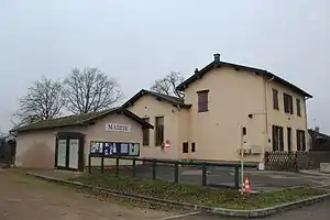 Mairie Dompierre-sur-Chalaronne | ||

Bevölkerungsentwicklung
| Jahr | 1962 | 1968 | 1975 | 1982 | 1990 | 1999 | 2008 | 2014 |
|---|---|---|---|---|---|---|---|---|
| Einwohner | 156 | 156 | 154 | 183 | 268 | 279 | 371 | 416 |
| Quellen: Cassini und INSEE | ||||||||
Sehenswürdigkeiten
- Kirche Saint-Georges
- Salle Yves Mercier
- Kriegerdenkmal
- Wasserturm
- Flurkreuz „Croix du Barvet“
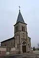 Kirche Saint-Georges
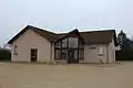 Salle Yves Mercier
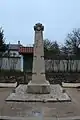 Kriegerdenkmal
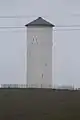 Wasserturm
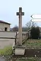 Flurkreuz
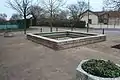 Springbrunnen bei der Mairie
Weblinks
Commons: Dompierre-sur-Chalaronne – Sammlung von Bildern, Videos und Audiodateien
This article is issued from Wikipedia. The text is licensed under Creative Commons - Attribution - Sharealike. The authors of the article are listed here. Additional terms may apply for the media files, click on images to show image meta data.