Le Plantay
Le Plantay ist eine französische Gemeinde mit 584 Einwohnern (Stand: 1. Januar 2019) im Département Ain in der Region Auvergne-Rhône-Alpes. Sie gehört zum Kanton Ceyzériat im Arrondissement Bourg-en-Bresse.
| Le Plantay | ||
|---|---|---|
.svg.png.webp)
|
| |
| Staat | Frankreich | |
| Region | Auvergne-Rhône-Alpes | |
| Département (Nr.) | Ain (01) | |
| Arrondissement | Bourg-en-Bresse | |
| Kanton | Ceyzériat | |
| Gemeindeverband | Dombes | |
| Koordinaten | 46° 1′ N, 5° 5′ O | |
| Höhe | 267–286 m | |
| Fläche | 20,65 km² | |
| Einwohner | 584 (1. Januar 2019) | |
| Bevölkerungsdichte | 28 Einw./km² | |
| Postleitzahl | 01330 | |
| INSEE-Code | 01299 | |
| Website | http://www.leplantay.wordpress.com/ | |
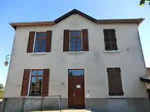 Bibliothek von Le Plantay | ||

Geographie
Le Plantay liegt etwa 18 Kilometer südsüdwestlich von Bourg-en-Bresse in den Dombes. Nachbargemeinden von Le Plantay sind Marlieux im Norden, Saint-Nizier-le-Désert im Osten und Nordosten, Chalamont im Osten und Südosten, Versailleux im Süden und Südosten sowie Villars-les-Dombes im Westen und Südwesten.
Bevölkerungsentwicklung
| Jahr | 1962 | 1968 | 1975 | 1982 | 1990 | 1999 | 2006 | 2019 |
| Einwohner | 323 | 300 | 281 | 339 | 344 | 417 | 512 | 584 |
| Quellen: Cassini und INSEE | ||||||||
Sehenswürdigkeiten
- Kirche Saint-Pierre, Monument historique seit 2008
- Turm Le Châtel, seit 1991 Monument historique
- Kloster Notre-Dame, 1863 gegründet
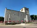 Kirche Saint-Pierre
 Kloster Notre-Dame des Dombes
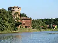 Turm Le Châtel
Weblinks
Commons: Le Plantay – Sammlung von Bildern, Videos und Audiodateien
This article is issued from Wikipedia. The text is licensed under Creative Commons - Attribution - Sharealike. The authors of the article are listed here. Additional terms may apply for the media files, click on images to show image meta data.