Dompierre-sous-Sanvignes
Dompierre-sous-Sanvignes ist eine französische Gemeinde mit 81 Einwohnern (Stand 1. Januar 2019) im Département Saône-et-Loire in der Region Bourgogne-Franche-Comté (vor 2016 Bourgogne). Sie gehört zum Arrondissement Charolles und zum Kanton Gueugnon (bis 2015 Toulon-sur-Arroux).
| Dompierre-sous-Sanvignes | ||
|---|---|---|
| ||
| Staat | Frankreich | |
| Region | Bourgogne-Franche-Comté | |
| Département (Nr.) | Saône-et-Loire (71) | |
| Arrondissement | Charolles | |
| Kanton | Gueugnon | |
| Gemeindeverband | Entre Arroux, Loire et Somme | |
| Koordinaten | 46° 39′ N, 4° 14′ O | |
| Höhe | 275–344 m | |
| Fläche | 13,64 km² | |
| Einwohner | 81 (1. Januar 2019) | |
| Bevölkerungsdichte | 6 Einw./km² | |
| Postleitzahl | 71420 | |
| INSEE-Code | 71179 | |
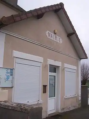 Rathaus (Mairie) von Dompierre-sous-Sanvignes | ||

Geographie
Dompierre-sous-Sanvignes liegt etwa 67 Kilometer ostnordöstlich von Moulins. Nachbargemeinden von Dompierre-sous-Sanvignes sind Saint-Eugène im Norden, Sanvignes-les-Mines im Norden und Osten, Perrecy-les-Forges im Süden, Saint-Romain-sous-Versigny im Westen und Südwesten sowie Toulon-sur-Arroux im Westen und Nordwesten.
Bevölkerungsentwicklung
| Jahr | 1962 | 1968 | 1975 | 1982 | 1990 | 1999 | 2006 | 2011 | 2016 |
| Einwohner | 140 | 121 | 100 | 94 | 80 | 79 | 75 | 72 | 77 |
| Quelle: Cassini und INSEE | |||||||||
Sehenswürdigkeiten
- Schloss mit Schlosskapelle
This article is issued from Wikipedia. The text is licensed under Creative Commons - Attribution - Sharealike. The authors of the article are listed here. Additional terms may apply for the media files, click on images to show image meta data.