Montmort
Montmort ist eine französische Gemeinde mit 183 Einwohnern (Stand: 1. Januar 2019) im Département Saône-et-Loire in der Region Bourgogne-Franche-Comté. Sie gehört zum Arrondissement Charolles und zum Kanton Gueugnon. Die Einwohner werden Montmortois genannt.
| Montmort | ||
|---|---|---|
| ||
| Staat | Frankreich | |
| Region | Bourgogne-Franche-Comté | |
| Département (Nr.) | Saône-et-Loire (71) | |
| Arrondissement | Charolles | |
| Kanton | Gueugnon | |
| Gemeindeverband | Entre Arroux, Loire et Somme | |
| Koordinaten | 46° 44′ N, 4° 5′ O | |
| Höhe | 248–486 m | |
| Fläche | 31,67 km² | |
| Einwohner | 183 (1. Januar 2019) | |
| Bevölkerungsdichte | 6 Einw./km² | |
| Postleitzahl | 71320 | |
| INSEE-Code | 71317 | |
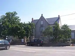 Rathaus (Mairie) von Montmort | ||

Geographie
Montmort liegt etwa 31 Kilometer südwestlich von Autun. Nachbargemeinden von Montmort sind Charbonnat im Norden und Nordosten, La Boulaye im Osten, Toulon-sur-Arroux im Südosten, Sainte-Radegonde im Süden, Issy-l’Évêque im Westen sowie Cuzy im Westen und Nordwesten.
Bevölkerungsentwicklung
| Jahr | 1962 | 1968 | 1975 | 1982 | 1990 | 1999 | 2006 | 2013 |
| Einwohner | 380 | 332 | 292 | 271 | 220 | 183 | 179 | 203 |
| Quelle: Cassini und INSEE | ||||||||
Sehenswürdigkeiten
- Kirche Saint-Bonnet
This article is issued from Wikipedia. The text is licensed under Creative Commons - Attribution - Sharealike. The authors of the article are listed here. Additional terms may apply for the media files, click on images to show image meta data.