Hautefond
Hautefond ist eine französische Gemeinde mit 202 Einwohnern (Stand: 1. Januar 2019) im Département Saône-et-Loire in der Region Bourgogne-Franche-Comté (vor 2016 Bourgogne). Sie gehört zum Arrondissement Charolles und zum Kanton Paray-le-Monial.
| Hautefond | ||
|---|---|---|
| ||
| Staat | Frankreich | |
| Region | Bourgogne-Franche-Comté | |
| Département (Nr.) | Saône-et-Loire (71) | |
| Arrondissement | Charolles | |
| Kanton | Paray-le-Monial | |
| Gemeindeverband | Communauté de communes de Marcigny | |
| Koordinaten | 46° 26′ N, 4° 12′ O | |
| Höhe | 243–338 m | |
| Fläche | 13,60 km² | |
| Einwohner | 202 (1. Januar 2019) | |
| Bevölkerungsdichte | 15 Einw./km² | |
| Postleitzahl | 71600 | |
| INSEE-Code | 71232 | |
| Website | https://www.hautefond.fr/ | |
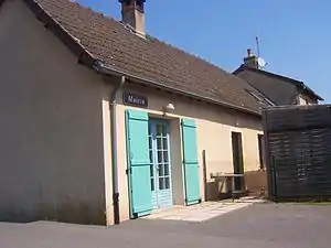 Rathaus (Mairie) von Hautefond | ||

Geographie
Hautefond liegt in der Landschaft Charolais. Nachbargemeinden von Hautefond sind Volesvres im Norden, Champlecy im Nordosten, Lugny-lès-Charolles im Osten und Südosten, Nochize im Süden sowie Paray-le-Monial im Westen.
Bevölkerungsentwicklung
| Jahr | 1962 | 1968 | 1975 | 1982 | 1990 | 1999 | 2006 | 2011 | 2016 |
| Einwohner | 181 | 177 | 168 | 175 | 186 | 227 | 215 | 211 | 210 |
| Quelle: Cassini und INSEE | |||||||||
This article is issued from Wikipedia. The text is licensed under Creative Commons - Attribution - Sharealike. The authors of the article are listed here. Additional terms may apply for the media files, click on images to show image meta data.