Boëssé-le-Sec
Boëssé-le-Sec ist eine französische Gemeinde mit 575 Einwohnern (Stand: 1. Januar 2019) im Arrondissement Mamers im Département Sarthe in der Region Pays de la Loire. Le Luart gehört zum Kanton La Ferté-Bernard (bis 2015: Kanton Tuffé) und zum Gemeindeverband Communauté de communes du Pays de l’Huisne Sarthoise. Die Einwohner werden Boësséens genannt.
| Boëssé-le-Sec | ||
|---|---|---|
| ||
| Staat | Frankreich | |
| Region | Pays de la Loire | |
| Département (Nr.) | Sarthe (72) | |
| Arrondissement | Mamers | |
| Kanton | La Ferté-Bernard | |
| Gemeindeverband | Pays de l’Huisne Sarthoise | |
| Koordinaten | 48° 8′ N, 0° 34′ O | |
| Höhe | 72–163 m | |
| Fläche | 11,96 km² | |
| Einwohner | 575 (1. Januar 2019) | |
| Bevölkerungsdichte | 48 Einw./km² | |
| Postleitzahl | 72400 | |
| INSEE-Code | 72038 | |
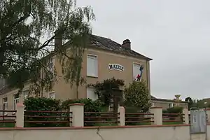 Rathaus (Mairie) von Boëssé-le-Sec | ||

Geographie
Boëssé-le-Sec liegt etwa 30 Kilometer ostnordöstlich von Le Mans. Umgeben wird Boëssé-le-Sec von den Nachbargemeinden La Bosse im Norden, Saint-Martin-des-Monts im Nordosten, Villaines-la-Gonais im Osten, Sceaux-sur-Huisne im Süden und Südosten, Tuffé Val de la Chéronne im Süden und Westen sowie Saint-Denis-des-Coudrais im Nordwesten.
Bevölkerungsentwicklung
| 1962 | 1968 | 1975 | 1982 | 1990 | 1999 | 2006 | 2013 |
|---|---|---|---|---|---|---|---|
| 648 | 664 | 726 | 615 | 590 | 596 | 644 | 622 |
| Quelle: Cassini und INSEE | |||||||
Sehenswürdigkeiten
- Kirche Notre-Dame

Kirche Notre-Dame
This article is issued from Wikipedia. The text is licensed under Creative Commons - Attribution - Sharealike. The authors of the article are listed here. Additional terms may apply for the media files, click on images to show image meta data.