Mézières-sur-Ponthouin
Mézières-sur-Ponthouin ist eine französische Gemeinde mit 732 Einwohnern (Stand: 1. Januar 2019) im Département Sarthe in der Region Pays de la Loire. Sie liegt im Arrondissement Mamers und war bis 2015 Teil des Kantons Marolles-les-Braults und gehört seither zum Kanton Mamers. Die Einwohner werden Macériens genannt.
| Mézières-sur-Ponthouin | ||
|---|---|---|
| ||
| Staat | Frankreich | |
| Region | Pays de la Loire | |
| Département (Nr.) | Sarthe (72) | |
| Arrondissement | Mamers | |
| Kanton | Mamers | |
| Gemeindeverband | Maine Saosnois | |
| Koordinaten | 48° 12′ N, 0° 18′ O | |
| Höhe | 59–127 m | |
| Fläche | 18,07 km² | |
| Einwohner | 732 (1. Januar 2019) | |
| Bevölkerungsdichte | 41 Einw./km² | |
| Postleitzahl | 72260 | |
| INSEE-Code | 72196 | |
| Website | http://www.mairie-mezieres-sur-ponthouin.fr/ | |
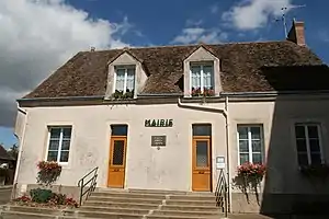 Rathaus (Mairie) von Mézières-sur-Ponthouin | ||

Geographie
Mézières-sur-Ponthouin liegt etwa 20 Kilometer nordnordöstlich von Le Mans und wird umgeben von den Nachbargemeinden Dangeul im Norden und Nordwesten, Dissé-sous-Ballon im Norden, Saint-Aignan im Osten und Nordosten, Courcemont im Süden und Südosten, Ballon-Saint-Mars im Süden und Südwesten sowie Congé-sur-Orne im Westen.
Einwohnerentwicklung
| 1962 | 1968 | 1975 | 1982 | 1990 | 1999 | 2006 | 2013 |
|---|---|---|---|---|---|---|---|
| 713 | 861 | 690 | 631 | 598 | 576 | 672 | 681 |
| Quelle: Cassini und INSEE | |||||||
Sehenswürdigkeiten
- Kirche Saint-Mamert in Ponthouin aus dem 11. Jahrhundert
- Kirche Notre-Dame in Mézières aus dem 11. Jahrhundert
- Alte Mühle von Saint-Laumer

Kirche Notre-Dame
This article is issued from Wikipedia. The text is licensed under Creative Commons - Attribution - Sharealike. The authors of the article are listed here. Additional terms may apply for the media files, click on images to show image meta data.