La Boissière (Eure)
La Boissière ist eine französische Gemeinde mit 266 Einwohnern (Stand 1. Januar 2019) im Département Eure in der Region Normandie (vor 2016 Haute-Normandie). Sie gehört zum Arrondissement Les Andelys (bis 2017 Évreux) und zum Kanton Pacy-sur-Eure (bis 2015 Saint-André-de-l’Eure). Die Einwohner werden Buxériens genannt.
| La Boissière | ||
|---|---|---|
.svg.png.webp)
|
| |
| Staat | Frankreich | |
| Region | Normandie | |
| Département (Nr.) | Eure (27) | |
| Arrondissement | Les Andelys | |
| Kanton | Pacy-sur-Eure | |
| Gemeindeverband | Seine Normandie Agglomération | |
| Koordinaten | 48° 57′ N, 1° 22′ O | |
| Höhe | 98–146 m | |
| Fläche | 3,46 km² | |
| Einwohner | 266 (1. Januar 2019) | |
| Bevölkerungsdichte | 77 Einw./km² | |
| Postleitzahl | 27220 | |
| INSEE-Code | 27078 | |
| Website | http://blog.laboissiere.org/ | |
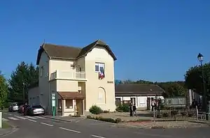 Rathaus (Mairie) von La Boissière | ||

Geografie
La Boissière liegt etwa 19 Kilometer ostsüdöstlich von Évreux. Umgeben wird La Boissière von den Nachbargemeinden Le Plessis-Hébert im Norden, Merey im Osten und Nordosten, Épieds im Südosten, Serez im Süden und Südwesten, Bretagnolles im Westen sowie Boisset-les-Prévanches im Nordwesten.
Bevölkerungsentwicklung
| Jahr | 1962 | 1968 | 1975 | 1982 | 1990 | 1999 | 2006 | 2013 |
| Einwohner | 93 | 101 | 86 | 121 | 176 | 225 | 256 | 271 |
| Quelle: Cassini und INSEE | ||||||||
Sehenswürdigkeiten
- Kirche Saint-Jacques
This article is issued from Wikipedia. The text is licensed under Creative Commons - Attribution - Sharealike. The authors of the article are listed here. Additional terms may apply for the media files, click on images to show image meta data.