Bézu-Saint-Éloi
| Bézu-Saint-Éloi | ||
|---|---|---|
.svg.png.webp)
|
| |
| Staat | Frankreich | |
| Region | Normandie | |
| Département (Nr.) | Eure (27) | |
| Arrondissement | Les Andelys | |
| Kanton | Gisors | |
| Gemeindeverband | Vexin Normand | |
| Koordinaten | 49° 18′ N, 1° 42′ O | |
| Höhe | 48–117 m | |
| Fläche | 11,48 km² | |
| Einwohner | 1.549 (1. Januar 2019) | |
| Bevölkerungsdichte | 135 Einw./km² | |
| Postleitzahl | 27660 | |
| INSEE-Code | 27067 | |
| Website | http://www.mairie-bezu-saint-eloi.fr/ | |

Bézu-Saint-Éloi ist eine französische Gemeinde mit 1.549 Einwohnern (Stand: 1. Januar 2019) im Département Eure in der Region Normandie. Sie gehört zum Arrondissement Les Andelys und zum Kanton Gisors. Die Einwohner werden Baciviens genannt.
Geographie
Bézu-Saint-Éloi liegt etwa 47 Kilometer ostsüdöstlich von Rouen. Umgeben wird Bézu-Saint-Éloi von den Nachbargemeinden Heudicourt im Norden, Saint-Denis-le-Ferment im Norden und Nordosten, Gisors im Osten, Neaufles-Saint-Martin im Südosten, Bernouville im Süden sowie Étrépagny im Westen und Nordwesten.
Bevölkerungsentwicklung
| Jahr | 1962 | 1968 | 1975 | 1982 | 1990 | 1999 | 2006 | 2016 |
| Einwohner | 678 | 750 | 747 | 730 | 1061 | 1170 | 1196 | 1491 |
| Quelle: Cassini und INSEE | ||||||||
Sehenswürdigkeiten
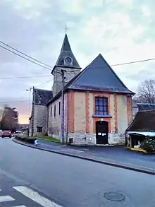
Kirche Saint-Rémi
- Kirche Saint-Rémi
This article is issued from Wikipedia. The text is licensed under Creative Commons - Attribution - Sharealike. The authors of the article are listed here. Additional terms may apply for the media files, click on images to show image meta data.