Concoret
Concoret (bretonisch Konkored) ist eine französische Gemeinde mit 737 Einwohnern (Stand 1. Januar 2019) im Département Morbihan in der Region Bretagne. Sie gehört zum Arrondissement Pontivy und zum Kanton Ploërmel.
| Concoret Konkored | ||
|---|---|---|
.svg.png.webp)
|
| |
| Staat | Frankreich | |
| Region | Bretagne | |
| Département (Nr.) | Morbihan (56) | |
| Arrondissement | Pontivy | |
| Kanton | Ploërmel | |
| Gemeindeverband | Ploërmel Communauté | |
| Koordinaten | 48° 4′ N, 2° 12′ W | |
| Höhe | 66–133 m | |
| Fläche | 15,81 km² | |
| Einwohner | 737 (1. Januar 2019) | |
| Bevölkerungsdichte | 47 Einw./km² | |
| Postleitzahl | 56430 | |
| INSEE-Code | 56043 | |
| Website | http://concoret.fr/ | |
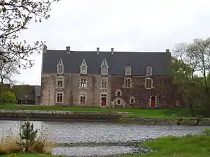
 Schloss Comper | ||
Geografie

Le Rocher du « Pas de la Chèvre »
Die Gemeinde liegt am Nordwestrand des 9.000 ha großen Forêt de Paimpont, dem Rest des sagenhaften Brocéliande, etwa 20 Kilometer nordöstlich von Ploërmel und rund 40 Kilometer westlich von Rennes. Im Norden, Osten und Süden grenzt das Gemeindegebiet von Concoret an das Département Ille-et-Vilaine.
Bevölkerungsentwicklung
| Jahr | 1962 | 1968 | 1975 | 1982 | 1990 | 1999 | 2008 |
| Einwohner | 614 | 683 | 731 | 668 | 626 | 645 | 777 |
Sehenswürdigkeiten
- Eiche von Guillotin (ca. 600 Jahre alt)
- Schloss Comper, Monument historique[1]
Literatur
- Le Patrimoine des Communes du Morbihan. Flohic Editions, Band 2, Paris 1996, ISBN 2-84234-009-4, S. 590–591.
Einzelnachweise
- Eintrag in der Base Mérimée des Kulturministeriums (französisch)
Weblinks
Commons: Concoret – Sammlung von Bildern, Videos und Audiodateien
- Concoret auf cc-mauron-broceliande.com (französisch)
This article is issued from Wikipedia. The text is licensed under Creative Commons - Attribution - Sharealike. The authors of the article are listed here. Additional terms may apply for the media files, click on images to show image meta data.
