Saint-Martin-des-Prés
| Saint-Martin-des-Prés Sant-Varzhin-Korle | ||
|---|---|---|
.svg.png.webp)
|
| |
| Staat | Frankreich | |
| Region | Bretagne | |
| Département (Nr.) | Côtes-d’Armor (22) | |
| Arrondissement | Saint-Brieuc | |
| Kanton | Mûr-de-Bretagne | |
| Gemeindeverband | Loudéac Communauté – Bretagne Centre | |
| Koordinaten | 48° 18′ N, 2° 57′ W | |
| Höhe | 166–322 m | |
| Fläche | 20,69 km² | |
| Einwohner | 306 (1. Januar 2019) | |
| Bevölkerungsdichte | 15 Einw./km² | |
| Postleitzahl | 22320 | |
| INSEE-Code | 22313 | |
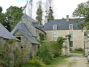 Kapelle des Herrenhauses Cléhunault | ||

Saint-Martin-des-Prés (bretonisch: Sant-Varzhin-Korle) ist eine französische Gemeinde mit 306 Einwohnern (Stand: 1. Januar 2019) im Département Côtes-d’Armor in der Region Bretagne.
Geographie
Umgeben wird Saint-Martin-des-Prés von den Gemeinden La Harmoye im Norden, von Allineuc im Osten, von Saint-Gilles-Vieux-Marché im Süden und von Corlay im Westen. Etwa drei Kilometer östlich der Gemeinde befindet sich der Stausee Barrage de Bosméléac.
Bevölkerungsentwicklung
| 1962 | 1968 | 1975 | 1982 | 1990 | 1999 | 2008 | 2012 |
| 684 | 592 | 509 | 416 | 385 | 366 | 352 | 331 |
Sehenswürdigkeiten
Siehe: Liste der Monuments historiques in Saint-Martin-des-Prés
Literatur
- Le Patrimoine des Communes des Côtes-d’Armor. Flohic Editions, Band 1, Paris 1998, ISBN 2-84234-017-5, S. 217–220.
Weblinks
Commons: Saint-Martin-des-Prés – Sammlung von Bildern, Videos und Audiodateien
This article is issued from Wikipedia. The text is licensed under Creative Commons - Attribution - Sharealike. The authors of the article are listed here. Additional terms may apply for the media files, click on images to show image meta data.