Liste der Geotope im Landkreis Freudenstadt
Diese sortierbare Liste der Geotope im Landkreis Freudenstadt enthält die Geotope des baden-württembergischen Landkreises Freudenstadt, die amtlichen Bezeichnungen für Namen und Nummern sowie deren geographische Lage. Die Geotope sind im Geotop-Kataster Baden-Württemberg dokumentiert und umfassen Aufschlüsse von Gesteinen, Böden, Mineralien und Fossilien sowie besondere Landschaftsteile.[1]
Liste
Im Landkreis sind 98 Geotope (Stand 22. Januar 2020) offiziell vom Landesamt für Geologie, Rohstoffe und Bergbau (LGRB) ausgewiesen:[2]
| Steckbrief Nr. (PDF) | Name | Geotoptyp | Gemeinde/Stadt, Gemarkung | Koordinaten | Bild | Bemerkungen |
|---|---|---|---|---|---|---|
| 1049 | Teufelskanzel | Felsformation | Bad Rippoldsau-Schapbach Gemarkung Bad Rippoldsau |
48° 26′ 55,8″ N, 8° 16′ 27,4″ O | Geologische Einheit: Mittlerer Buntsandstein Status: geschützt (Naturdenkmal Teufelskanzel) | |
| 1050 | Kastelstein | Felsformation | Bad Rippoldsau-Schapbach Gemarkung Bad Rippoldsau |
48° 26′ 50,3″ N, 8° 19′ 16,3″ O | 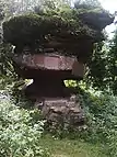 |
Geologische Einheit: Mittlerer Buntsandstein Status: geschützt (Naturdenkmal Sandsteinblock "Kastelstein") |
| 1051 | Absbachwasserfall | Wasserfall | Bad Rippoldsau-Schapbach Gemarkung Bad Rippoldsau |
48° 26′ 10,7″ N, 8° 16′ 23,6″ O | Geologische Einheit: Mittlerer Buntsandstein Status: geschützt (Naturdenkmal Absbachwasserfall) | |
| 1052 | Erzknappenfelsen | Felsformation | Bad Rippoldsau-Schapbach Gemarkung Bad Rippoldsau |
48° 24′ 10″ N, 8° 19′ 3,9″ O | Geologische Einheit: Mittlerer Buntsandstein Status: geschützt (Naturdenkmal Erzknappenfelsen) | |
| 1053 | Glackstein (Klagstein) | Felsformation | Bad Rippoldsau-Schapbach Gemarkung Schapbach |
48° 24′ 50″ N, 8° 15′ 17,7″ O | Geologische Einheit: Mittlerer Buntsandstein Status: geschützt (Naturdenkmal Sandsteinblock "Glackstein" ("Klagstein")) | |
| 1054 | Glaswaldsee ca. 4000 m W von Bad Rippoldsau | Kar | Bad Rippoldsau-Schapbach Gemarkung Schapbach |
48° 25′ 32,6″ N, 8° 15′ 41,9″ O | 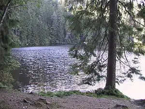 |
Geologische Einheit: Mittlerer Buntsandstein Status: mit geschützt (NSG Glaswaldsee) |
| 1055 | Buntsandsteinschlucht "Gierisloch" mit Gierisstein | Landschaftselement | Bad Rippoldsau-Schapbach Gemarkung Schapbach |
48° 20′ 58,9″ N, 8° 18′ 3,3″ O | Geologische Einheit: Mittlerer Buntsandstein Status: geschützt (Naturdenkmal Buntsandsteinschlucht "Gierisloch") | |
| 1056 | Pommersloch beim Dreifürstenstein/Hornisgrinde | Kar | Baiersbronn | 48° 36′ 9,5″ N, 8° 12′ 42,2″ O | Geologische Einheit: Mittlerer Buntsandstein Status: mit geschützt (Nationalpark Schwarzwald) | |
| 1057 | Wildseekar am östl. Seekopf ca. 4600 m SW der Hornisgrinde | Kar | Baiersbronn | 48° 34′ 10,4″ N, 8° 14′ 21,6″ O |  |
Geologische Einheit: Unterer Buntsandstein Status: mit geschützt (Nationalpark Schwarzwald) |
| 1058 | Kar am Pfälzerkopf ca. 6000 m SE der Hornisgrinde | Kar | Baiersbronn | 48° 33′ 45,9″ N, 8° 15′ 24,9″ O | Geologische Einheit: Unterer Buntsandstein Status: mit geschützt (Nationalpark Schwarzwald) | |
| 1059 | Kar im Sauloch ca. 3300 m NNW von Obertal | Kar | Baiersbronn | 48° 33′ 38,1″ N, 8° 16′ 14,8″ O | Geologische Einheit: Unterer Buntsandstein Status: mit geschützt (Nationalpark Schwarzwald) | |
| 1060 | Kar "Saumüsse" ca. 2600 m N von Obertal | Kar | Baiersbronn | 48° 33′ 25,6″ N, 8° 16′ 39,8″ O | Geologische Einheit: Unterer Buntsandstein Status: mit geschützt (Nationalpark Schwarzwald) | |
| 1061 | Kar im Melkenteich ca. 1000 m S vom Ruhestein | Kar | Baiersbronn | 48° 33′ 11″ N, 8° 13′ 11,8″ O | Geologische Einheit: Unterer Buntsandstein Status: mit geschützt (Nationalpark Schwarzwald) | |
| 1062 | Schliffkopf | Landschaftselement | Baiersbronn | 48° 32′ 7,8″ N, 8° 12′ 54,3″ O |  |
Geologische Einheit: Mittlerer Buntsandstein Status: mit geschützt (Nationalpark Schwarzwald) |
| 1063 | Kar im Schrofelteich ca. 4300 m W von Obertal | Kar | Baiersbronn | 48° 32′ 2,3″ N, 8° 13′ 44,6″ O | Geologische Einheit: Unterer Buntsandstein Status: mit geschützt (Nationalpark Schwarzwald) | |
| 1064 | Buhlbachsee ca. 5000 m SW von Obertal | Kar | Baiersbronn | 48° 30′ 1,2″ N, 8° 14′ 42,9″ O | 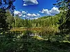 |
Geologische Einheit: Mittlerer Buntsandstein Status: mit geschützt (Nationalpark Schwarzwald) |
| 1065 | Ellbachsee N der Gemeinde Kniebis | Kar | Baiersbronn | 48° 28′ 57,9″ N, 8° 18′ 18,1″ O | .jpg.webp) |
Geologische Einheit: Mittlerer Buntsandstein Status: geschützt (Naturdenkmal Ellbachsee) |
| 1066 | Sankenbachwasserfall | Wasserfall | Baiersbronn | 48° 28′ 57,9″ N, 8° 18′ 18,1″ O |  |
Geologische Einheit: Unterer Buntsandstein Status: geschützt (Naturdenkmal Sankenbacher Wasserfälle) |
| 1067 | Bodenloser See, Empfingen | Doline | Empfingen | 48° 24′ 40,2″ N, 8° 42′ 24,9″ O | 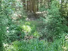 |
Geologische Einheit: Unterer Keuper Status: geschützt (Naturdenkmal Bodenloser See) |
| 1068 | Dießener Tuffsteinrinne | Tuffrinne | Horb am Neckar Gemarkung Diessen |
48° 25′ 38,8″ N, 8° 35′ 24,8″ O | 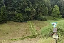 |
Geologische Einheit: Mittlerer Muschelkalk Status: mit geschützt (NSG Dießener Tal und Seitentäler) |
| 1069 | Ehem. Steinbruch NW Diessen | Aufschluss | Horb am Neckar Gemarkung Diessen |
48° 26′ 0,8″ N, 8° 35′ 11,5″ O | Geologische Einheit: Unterer Muschelkalk Status: mit geschützt (NSG Dießener Tal und Seitentäler) | |
| 1070 | Hohler Stein | Felsformation | Pfalzgrafenweiler | 48° 31′ 23,8″ N, 8° 34′ 59,6″ O | 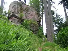 |
Geologische Einheit: Mittlerer Buntsandstein Status: geschützt (Naturdenkmal Hohler Stein) |
| 1071 | Kar im Talschluss des Buchbachs ca. 3700 m N von Alpirsbach | Kar | Alpirsbach Gemarkung Ehlenbogen |
48° 22′ 43,2″ N, 8° 23′ 52,7″ O | Geologische Einheit: Unterer Buntsandstein | |
| 1072 | Kar wenig unterh. vom Nonnenstein, ca. 2800 m N von Alpirsbach | Kar | Alpirsbach Gemarkung Ehlenbogen |
48° 22′ 13″ N, 8° 23′ 38″ O | Geologische Einheit: Unterer Buntsandstein | |
| 1073 | Alter Weiher am Osthang des Roßbergs wenig W des Stausees Kleine Kinzig | Kar | Alpirsbach Gemarkung Reinerzau |
48° 24′ 0,1″ N, 8° 21′ 26,4″ O | Geologische Einheit: Unterer Buntsandstein | |
| 1074 | Steinbruch am Bühlberg N von Rippoldsau-Schapbach | Aufschluss | Bad Rippoldsau-Schapbach Gemarkung Bad Rippoldsau |
48° 27′ 20,3″ N, 8° 17′ 9,9″ O | Geologische Einheit: Kristallines Grundgebirge | |
| 1075 | Burgbachwasserfall | Wasserfall | Bad Rippoldsau-Schapbach Gemarkung Bad Rippoldsau |
48° 24′ 36,3″ N, 8° 20′ 5,3″ O |  |
Geologische Einheit: Oberrotliegendes/ Granitisches Grundgebirge |
| 1076 | Kar beim Teufelsriss ca. 2700 m ENE von Bad Griesbach | Kar | Bad Rippoldsau-Schapbach Gemarkung Bad Rippoldsau |
48° 27′ 36,9″ N, 8° 16′ 30,7″ O | Geologische Einheit: Unterer Buntsandstein | |
| 1077 | Sommergrube ca. 2700 m E von Bad Griesbach | Kar | Bad Rippoldsau-Schapbach Gemarkung Bad Rippoldsau |
48° 27′ 14″ N, 8° 16′ 46,1″ O | Geologische Einheit: Unterer Buntsandstein | |
| 1078 | Kar im Sumpf ca. 3000 m WNW von Bad Rippoldsau | Kar | Bad Rippoldsau-Schapbach Gemarkung Bad Rippoldsau |
48° 26′ 24,2″ N, 8° 16′ 46,8″ O | Geologische Einheit: Unterer Buntsandstein | |
| 1079 | Kar unterhalb der Absbachhöhe ca. 2500 m WNW von Bad Rippoldsau | Kar | Bad Rippoldsau-Schapbach Gemarkung Bad Rippoldsau |
48° 26′ 8,9″ N, 8° 17′ 29,3″ O | Geologische Einheit: Unterer Buntsandstein | |
| 1080 | Kar in der Wasserebene ca. 2000 m WNW von Bad Rippoldsau | Kar | Bad Rippoldsau-Schapbach Gemarkung Bad Rippoldsau |
48° 26′ 3,7″ N, 8° 18′ 17,1″ O | Geologische Einheit: Rotliegend | |
| 1081 | Kar in der Seehalde ca. 600 m ESE vom Glaswaldsee, ca. 3700 m E von Bad Rippoldsau | Kar | Bad Rippoldsau-Schapbach Gemarkung Schapbach |
48° 25′ 26,7″ N, 8° 16′ 15″ O | Geologische Einheit: Unterer Buntsandstein | |
| 1082 | Kar im Gebiet "Wanne" ca. 3500 m WSW von Bad Rippoldsau | Kar | Bad Rippoldsau-Schapbach Gemarkung Schapbach |
48° 25′ 12,2″ N, 8° 16′ 31,8″ O | Geologische Einheit: Unterer Buntsandstein | |
| 1083 | Halde Grube Friedrich Christian, Bad Rippoldsau-Wildschapbach | Halde | Bad Rippoldsau-Schapbach Gemarkung Schapbach |
48° 23′ 4,2″ N, 8° 16′ 13,7″ O | ||
| 1084 | Aufg. Steinbruch an Strasse S Rippoldsau-Wildschapbach | Aufschluss | Bad Rippoldsau-Schapbach Gemarkung Schapbach |
48° 22′ 44,2″ N, 8° 16′ 23,7″ O | Geologische Einheit: Gneis | |
| 1085 | Aufschlüsse entlang Rotmurg NW Baiersbronn-Obertal (1) | Aufschluss | Baiersbronn | 48° 32′ 54,7″ N, 8° 14′ 25,7″ O | Geologische Einheit: Rotliegend | |
| 1086 | Aufschlüsse entlang Rotmurg NW Baiersbronn-Obertal (2) | Aufschluss | Baiersbronn | 48° 32′ 53,5″ N, 8° 14′ 50,1″ O | Geologische Einheit: Rotliegend | |
| 1087 | Aufschlüsse entlang Rotmurg NW Baiersbronn-Obertal (3) | Aufschluss | Baiersbronn | 48° 32′ 58,9″ N, 8° 15′ 27,1″ O | Geologische Einheit: Paragneis | |
| 1088 | Aufschlüsse entlang Rotmurg NW Baiersbronn-Obertal (4) | Aufschluss | Baiersbronn | 48° 32′ 41,4″ N, 8° 16′ 9,3″ O | Geologische Einheit: Paragneis | |
| 1089 | Aufschlüsse entlang Rotmurg NW Baiersbronn-Obertal (5) | Aufschluss | Baiersbronn | 48° 32′ 30,2″ N, 8° 16′ 32,8″ O | Geologische Einheit: Rotliegend | |
| 1090 | Aufschluss Buhlbachsaue SW Baiersbronn-Obertal | Aufschluss | Baiersbronn | 48° 31′ 32,6″ N, 8° 16′ 30,7″ O | Geologische Einheit: Rotliegend | |
| 1091 | Felsen Ruine Tannenfels, Baiersbronn-Obertal | Felsformation | Baiersbronn | 48° 31′ 39″ N, 8° 18′ 1,3″ O |  weitere Bilder |
Geologische Einheit: Unterer Buntsandstein |
| 1092 | Aufschluss im Ellbachtal S von Baiersbronn-Mitteltal | Aufschluss | Baiersbronn | 48° 30′ 7,4″ N, 8° 19′ 1″ O | Geologische Einheit: Gneis | |
| 1093 | Pudelstein im Steinmissekar, Baiersbronn-Tonbach | Felsformation | Baiersbronn | 48° 32′ 48,6″ N, 8° 20′ 46,1″ O | Geologische Einheit: Mittlerer Buntsandstein | |
| 1094 | Gebiet Elme W von Baiersbronn-Tonbach | Aufschluss | Baiersbronn | 48° 32′ 3,1″ N, 8° 20′ 17,5″ O | Geologische Einheit: Karneol-Horizont | |
| 1095 | Ehem. Steinbruch Stern W von Baiersbronn | Aufschluss | Baiersbronn | 48° 30′ 49,8″ N, 8° 21′ 0,8″ O | Geologische Einheit: Gneis | |
| 1096 | Ehem. Steinbruch am Rauhfels W von Baiersbronn | Aufschluss | Baiersbronn | 48° 30′ 49,6″ N, 8° 21′ 16,9″ O | Geologische Einheit: Gneis | |
| 1097 | Ehem. Steinbruch Aue am Rinkenkopf, Baiersbronn | Aufschluss | Baiersbronn | 48° 30′ 42″ N, 8° 21′ 44,3″ O | Geologische Einheit: Gneis | |
| 1098 | Kar Fischergrube ca. 2500 m NNE von Ruhestein | Kar | Baiersbronn | 48° 34′ 50,9″ N, 8° 14′ 24,9″ O | Geologische Einheit: Unterer Buntsandstein Status: mit geschützt (Nationalpark Schwarzwald) | |
| 1099 | Kar Klein-Leinkopf ca. 1200 m SSW von Zwickgabel | Kar | Baiersbronn | 48° 34′ 33,4″ N, 8° 18′ 39,9″ O | Geologische Einheit: Unterer Buntsandstein Status: mit geschützt (Nationalpark Schwarzwald) | |
| 1100 | Kar Pfälzergrub am Pfälzerkopf ca. 5300 m SE der Hornisgrinde | Kar | Baiersbronn | 48° 34′ 2,2″ N, 8° 14′ 52″ O | Geologische Einheit: Unterer Buntsandstein Status: mit geschützt (Nationalpark Schwarzwald) | |
| 1101 | Kammerloch ca. 2500 m WNW von Obertal | Kar Wasserfall |
Baiersbronn | 48° 32′ 21,6″ N, 8° 15′ 7,2″ O |  |
Geologische Einheit: Unterer Buntsandstein Status: mit geschützt (Nationalpark Schwarzwald) |
| 1102 | Kar Dölle ca. 2000 m NW von Obertal | Kar | Baiersbronn | 48° 32′ 23,8″ N, 8° 15′ 56,4″ O | Geologische Einheit: Unterer Buntsandstein | |
| 1103 | Aufg. Steinbruch und Weganschnitte an der Elme N von Mitteltal | Aufschluss | Baiersbronn | 48° 32′ 24,2″ N, 8° 19′ 38,2″ O | Geologische Einheit: Karneol-Horizont | |
| 1104 | Kar am Osthang des Gaiskopfs ca. 4300 m W von Obertal | Kar | Baiersbronn | 48° 31′ 42,8″ N, 8° 13′ 44,9″ O | Geologische Einheit: Unterer Buntsandstein Status: mit geschützt (Nationalpark Schwarzwald) | |
| 1105 | Kar Weiher direkt S oberh. von Obertal | Kar | Baiersbronn | 48° 31′ 42,9″ N, 8° 17′ 20,8″ O | Geologische Einheit: Unterer Buntsandstein | |
| 1106 | Ilgenbacher Grub am östl. Hang des Burgkopfs S von Obertal | Kar | Baiersbronn | 48° 31′ 12,2″ N, 8° 17′ 26,1″ O | Geologische Einheit: Unterer Buntsandstein | |
| 1107 | Schramberger Grub W von Mitteltal | Kar | Baiersbronn | 48° 31′ 3,4″ N, 8° 18′ 55,4″ O | Geologische Einheit: Unterer Buntsandstein | |
| 1108 | Kar beim Mosesbrunnen ca. 4500 m WSW von Obertal | Kar | Baiersbronn | 48° 30′ 43,7″ N, 8° 14′ 0,9″ O | Geologische Einheit: Unterer Buntsandstein Status: mit geschützt (Nationalpark Schwarzwald) | |
| 1109 | Kar im Bärteich ca. 4000 m SW von Obertal | Kar | Baiersbronn | 48° 30′ 10,9″ N, 8° 15′ 16,9″ O | Geologische Einheit: Unterer Buntsandstein Status: mit geschützt (Nationalpark Schwarzwald) | |
| 1110 | Kar Leiternstüble (auch Hirschlache) 2800 m SSW von Obertal | Kar | Baiersbronn | 48° 30′ 34,2″ N, 8° 16′ 15,5″ O | Geologische Einheit: Unterer Buntsandstein Status: mit geschützt (Nationalpark Schwarzwald) | |
| 1111 | Bletschermiß ca. 3300 m S von Obertal | Kar | Baiersbronn | 48° 30′ 12,6″ N, 8° 16′ 33,8″ O | Geologische Einheit: Unterer Buntsandstein Status: mit geschützt (Nationalpark Schwarzwald) | |
| 1112 | Hintere Grub ca. 2000 m SW von Mitteltal | Kar | Baiersbronn | 48° 30′ 43″ N, 8° 18′ 0,1″ O | Geologische Einheit: Unterer Buntsandstein | |
| 1113 | Rotegießen-Nord ca. 3000 m SW von Mitteltal | Kar | Baiersbronn | 48° 30′ 23″ N, 8° 17′ 28,2″ O | Geologische Einheit: Unterer Buntsandstein Status: mit geschützt (Nationalpark Schwarzwald) | |
| 1114 | Rotegießen-Süd ca. 3000 m SW von Mitteltal | Kar | Baiersbronn | 48° 30′ 10,1″ N, 8° 17′ 29,4″ O | Geologische Einheit: Unterer Buntsandstein Status: mit geschützt (Nationalpark Schwarzwald) | |
| 1115 | Klappermisse im hinteren Tonbachtal ca. 2000 m NW von Vorder-Tonbach | Kar | Baiersbronn | 48° 32′ 36″ N, 8° 20′ 51,2″ O | Geologische Einheit: Unterer Buntsandstein | |
| 1116 | Saumüß ca. 2500 m SE von Klosterreichenbach | Kar | Baiersbronn | 48° 30′ 24,3″ N, 8° 25′ 5,7″ O | Geologische Einheit: Unterer Buntsandstein | |
| 1117 | Weiher ca. 1200 m ENE der Alexanderschanze | Kar | Baiersbronn | 48° 29′ 0,8″ N, 8° 17′ 27,9″ O | Geologische Einheit: Unterer Buntsandstein Status: mit geschützt (Nationalpark Schwarzwald) | |
| 1118 | Kar in der Kienberghalde ca. 2300 m W von Baiersbronn | Kar | Baiersbronn | 48° 29′ 49,6″ N, 8° 20′ 47″ O | Geologische Einheit: Unterer Buntsandstein | |
| 1119 | Weihermiß ca. 500 m SE vom Sankenbachkessel bzw. 3500 m SW von Baiersbronn | Kar | Baiersbronn | 48° 28′ 44″ N, 8° 20′ 26,4″ O | Geologische Einheit: Unterer Buntsandstein | |
| 1120 | Wörnermiß am Westhang des Forbachtals W von Baiersbronn-Altaue | Kar | Baiersbronn | 48° 29′ 17,7″ N, 8° 22′ 15″ O | Geologische Einheit: Unterer Buntsandstein | |
| 1121 | Kar Marienplatz am W-Hang des Forbachtals W von Baiersbronn-Altaue | Kar | Baiersbronn | 48° 29′ 1,8″ N, 8° 22′ 6,5″ O | Geologische Einheit: Unterer Buntsandstein | |
| 1122 | Hahnbergloch ca. 3100 m WSW von Baiersbronn-Huzenbach | Kar | Baiersbronn Gemarkung Huzenbach |
48° 34′ 46,8″ N, 8° 20′ 52,9″ O | Geologische Einheit: Unterer Buntsandstein Status: mit geschützt (Nationalpark Schwarzwald) | |
| 1123 | Huzenbacher See ca. 3200 m WSW von Baiersbronn-Huzenbach | Kar | Baiersbronn Gemarkung Huzenbach |
48° 34′ 29″ N, 8° 20′ 54,6″ O | 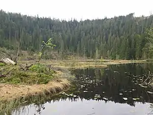 |
Geologische Einheit: Unterer Buntsandstein Status: mit geschützt (Nationalpark Schwarzwald) |
| 1124 | Schwarzmüsse (Schwarzmiß) ca. 3300 m WNW von Röt | Kar | Baiersbronn Gemarkung Huzenbach |
48° 34′ 7,9″ N, 8° 21′ 37,3″ O | Geologische Einheit: Unterer Buntsandstein Status: mit geschützt (Nationalpark Schwarzwald) | |
| 1125 | Kar in der Höll ca. 2000 m W von Heselbach | Kar | Baiersbronn Gemarkung Klosterreichenbach |
48° 32′ 31,1″ N, 8° 22′ 39″ O | Geologische Einheit: Unterer Buntsandstein | |
| 1126 | Seeloch ca. 1500 m NW von Röt | Kar | Baiersbronn Gemarkung Röttingen |
48° 34′ 0,5″ N, 8° 22′ 56,9″ O | Geologische Einheit: Unterer Buntsandstein | |
| 1127 | Aufschluss an der Bahnlinie, Schwarzenberg | Aufschluss | Baiersbronn Gemarkung Schwarzenberg |
48° 35′ 52,9″ N, 8° 23′ 4,8″ O | Geologische Einheit: Granulit | |
| 1128 | Doline S von Dettensee | Doline | Empfingen | 48° 24′ 33,2″ N, 8° 43′ 1″ O | Geologische Einheit: Unterer Keuper | |
| 1129 | Steinbruch an der Strasse Dietersweiler-Glatten | Aufschluss | Freudenstadt Gemarkung Dietersweiler |
48° 26′ 43,1″ N, 8° 29′ 29,1″ O | Geologische Einheit: Oberer Buntsandstein | |
| 1130 | Felswand am Kurmittelhaus, Freudenstadt | Aufschluss | Freudenstadt | 48° 27′ 28,7″ N, 8° 24′ 34,1″ O | Geologische Einheit: Mittlerer Buntsandstein | |
| 1131 | Urschenloch oberh. eines Seitentälchens zum Forbach ca. 1000 m WSW von Baiersbronn | Kar | Freudenstadt | 48° 28′ 34,4″ N, 8° 21′ 45,4″ O | Geologische Einheit: Unterer Buntsandstein | |
| 1132 | Kar im Jägerloch ca. 1000 m SSW von Baiersbronn-Reinhäusle | Kar | Freudenstadt | 48° 28′ 22,6″ N, 8° 22′ 9,4″ O | Geologische Einheit: Unterer Buntsandstein | |
| 1133 | Kar im Kohlwiesle am NE-Hang des Forbachtals ca. 1700 m WNW von Freudenstadt | Kar | Freudenstadt | 48° 28′ 9,7″ N, 8° 23′ 14,8″ O | Geologische Einheit: Unterer Buntsandstein | |
| 1134 | Franzosengrüble am NE-Hang des Forbachtals wenig W von Freudenstadt | Kar | Freudenstadt | 48° 27′ 53,4″ N, 8° 23′ 57,8″ O | Geologische Einheit: Unterer Buntsandstein | |
| 1135 | Kar beim Bärenschloß wenig SW von Freudenstadt | Kar | Freudenstadt | 48° 27′ 37″ N, 8° 24′ 15,5″ O | Geologische Einheit: Unterer Buntsandstein | |
| 1136 | Kar bei der Schleh'schen Mahlmühle im hint. Forbachtal ca. 2600 m SW von Freudenstadt | Kar | Freudenstadt | 48° 27′ 17,7″ N, 8° 22′ 43,8″ O | Geologische Einheit: Unterer Buntsandstein | |
| 1137 | Kar im Schnakenloch im hint. Forbachtal ca. 2400 m SW von Freudenstadt | Kar | Freudenstadt | 48° 27′ 12,6″ N, 8° 23′ 4,3″ O | Geologische Einheit: Unterer Buntsandstein | |
| 1138 | Steinbruch Hessenwiesen E von Dietersweiler | Aufschluss | Glatten | 48° 26′ 42,2″ N, 8° 29′ 29,1″ O | Geologische Einheit: Unterer Buntsandstein | |
| 1139 | See im Seehaus S von Grünmettstetten | Landschaftselement | Horb am Neckar Gemarkung Grünmettstetten |
48° 26′ 49,1″ N, 8° 36′ 56,2″ O | 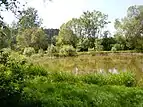 |
Geologische Einheit: Oberer Muschelkalk |
| 1140 | Ehem. Steinbruch beim Kegelhof W von Horb | Aufschluss | Horb am Neckar | 48° 27′ 4″ N, 8° 40′ 42,9″ O | Geologische Einheit: Oberer Muschelkalk | |
| 1141 | Felswand im Haugenloch E von Horb | Aufschluss | Horb am Neckar | 48° 27′ 1,3″ N, 8° 42′ 12,9″ O | 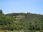 |
Geologische Einheit: Oberer Muschelkalk |
| 1142 | N-Einfahrt des Loßburger Tunnels, Loßburg | Aufschluss | Loßburg | 48° 24′ 49,8″ N, 8° 27′ 3,3″ O | Geologische Einheit: Oberer Buntsandstein | |
| 1143 | Karmulde bei der Lohmühle ca. 3000 m WSW von Loßburg | Kar | Loßburg Gemarkung Schömberg |
48° 23′ 59″ N, 8° 24′ 58″ O | Geologische Einheit: Unterer Buntsandstein | |
| 1144 | Kar im Haugenloch ca. 2700 m SW von Loßburg | Kar | Loßburg Gemarkung Schömberg |
48° 23′ 33,9″ N, 8° 25′ 26,4″ O | Geologische Einheit: Unterer Buntsandstein | |
| 1145 | Kar im Erzbrunnen ca. 1600 m SW von Gompelscheuer | Kar | Seewald Gemarkung Besenfeld |
48° 37′ 31,2″ N, 8° 25′ 50,1″ O | Geologische Einheit: Unterer Buntsandstein | |
| 1146 | Kessel W oberh. von Schorrental ca. 2000 m SE von Seewald | Kar | Seewald Gemarkung Besenfeld |
48° 34′ 59,8″ N, 8° 26′ 19,6″ O | Geologische Einheit: Unterer Buntsandstein |
Siehe auch
Weblinks
Commons: Geotope im Landkreis Freudenstadt – Sammlung von Bildern, Videos und Audiodateien
Einzelnachweise
- LGRB, Geotourismus, Geotop-Kataster. In: lgrb-bw.de. Abgerufen am 7. Februar 2021.
- LGRB-Kartenviewer. In: maps.lgrb-bw.de. Abgerufen am 7. Februar 2021.
This article is issued from Wikipedia. The text is licensed under Creative Commons - Attribution - Sharealike. The authors of the article are listed here. Additional terms may apply for the media files, click on images to show image meta data.
