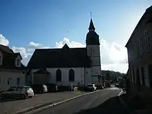
Francières (Somme)
Francières (picardisch: Franciére) ist eine nordfranzösische Gemeinde mit 182 Einwohnern (Stand 1. Januar 2019) im Département Somme in der Region Hauts-de-France. Die Gemeinde liegt im Arrondissement Abbeville und ist Teil der Communauté de communes Ponthieu-Marquenterre und des Kantons Rue.
| Francières | ||
|---|---|---|
| ||
| Staat | Frankreich | |
| Region | Hauts-de-France | |
| Département (Nr.) | Somme (80) | |
| Arrondissement | Abbeville | |
| Kanton | Rue | |
| Gemeindeverband | Ponthieu-Marquenterre | |
| Koordinaten | 50° 4′ N, 1° 57′ O | |
| Höhe | 33–110 m | |
| Fläche | 5,87 km² | |
| Einwohner | 182 (1. Januar 2019) | |
| Bevölkerungsdichte | 31 Einw./km² | |
| Postleitzahl | 80690 | |
| INSEE-Code | 80344 | |
.JPG.webp) Rathaus- und Schulgebäude | ||

Geographie
Die Gemeinde liegt rund 7,5 km südlich von Saint-Riquier und 4,5 km westlich von Ailly-le-Haut-Clocher und wird im Norden von der früheren Route nationale 35 begrenzt. Die Autoroute A 16 verläuft durch das nördliche Gemeindegebiet. Das Gemeindegebiet liegt im Regionalen Naturpark Baie de Somme Picardie Maritime.
Einwohner
| 1962 | 1968 | 1975 | 1982 | 1990 | 1999 | 2006 | 2011 |
|---|---|---|---|---|---|---|---|
| 154 | 129 | 140 | 142 | 129 | 127 | 174 | 198 |
Einzelnachweise
Weblinks
Commons: Francières – Sammlung von Bildern, Videos und Audiodateien
This article is issued from Wikipedia. The text is licensed under Creative Commons - Attribution - Sharealike. The authors of the article are listed here. Additional terms may apply for the media files, click on images to show image meta data.