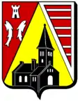
Montreux (Meurthe-et-Moselle)
| Montreux | ||
|---|---|---|

|
| |
| Staat | Frankreich | |
| Region | Grand Est | |
| Département (Nr.) | Meurthe-et-Moselle (54) | |
| Arrondissement | Lunéville | |
| Kanton | Baccarat | |
| Gemeindeverband | Vezouze en Piémont | |
| Koordinaten | 48° 32′ N, 6° 53′ O | |
| Höhe | 277–345 m | |
| Fläche | 3,80 km² | |
| Einwohner | 55 (1. Januar 2019) | |
| Bevölkerungsdichte | 14 Einw./km² | |
| Postleitzahl | 54450 | |
| INSEE-Code | 54381 | |
_mairie.jpg.webp) Mairie Montreux | ||
Montreux ist eine französische Gemeinde mit 55 Einwohnern (Stand 1. Januar 2019) im Département Meurthe-et-Moselle in der Region Grand Est. Sie gehört zum Kanton Baccarat und zum Arrondissement Lunéville.
Nachbargemeinden sind Nonhigny im Norden, Parux im Nordosten, Bréménil im Südosten, Neuviller-lès-Badonviller im Südwesten, Ancerviller im Westen sowie Halloville im Nordwesten.
Ortsname
Auf lateinisch hieß die Siedlung „Monasteriolum“. Um 880 existierte der Name „Munsteriolo“.
Bevölkerungsentwicklung
| Jahr | 1962 | 1968 | 1975 | 1982 | 1990 | 1999 | 2008 | 2019 |
|---|---|---|---|---|---|---|---|---|
| Einwohner | 94 | 93 | 83 | 85 | 59 | 61 | 58 | 55 |
_%C3%A9glise_(02).jpg.webp)
Himmelfahrtskirche
This article is issued from Wikipedia. The text is licensed under Creative Commons - Attribution - Sharealike. The authors of the article are listed here. Additional terms may apply for the media files, click on images to show image meta data.
