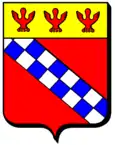
Frémonville
| Frémonville | ||
|---|---|---|

|
| |
| Staat | Frankreich | |
| Region | Grand Est | |
| Département (Nr.) | Meurthe-et-Moselle (54) | |
| Arrondissement | Lunéville | |
| Kanton | Baccarat | |
| Gemeindeverband | Vezouze en Piémont | |
| Koordinaten | 48° 36′ N, 6° 53′ O | |
| Höhe | 264–364 m | |
| Fläche | 14,06 km² | |
| Einwohner | 189 (1. Januar 2019) | |
| Bevölkerungsdichte | 13 Einw./km² | |
| Postleitzahl | 54450 | |
| INSEE-Code | 54211 | |
_mairie.jpg.webp) Mairie (Rathaus) der Gemeinde | ||
Frémonville (1363: Fremetingen[1]) ist eine französische Gemeinde im Département Meurthe-et-Moselle in der Region Grand Est (bis 2015 Lothringen).
Geografie
Die Gemeinde Frémonville liegt an der Vezouze am nordwestlichen Rand der Vogesen, etwa 28 Kilometer östlich von Lunéville. Das Gemeindegebiet grenzt im Norden an das Département Moselle. Nachbargemeinden von Frémonville sind Richeval im Norden, Hattigny und Tanconville im Nordosten, Cirey-sur-Vezouze im Osten, Harbouey im Süden, Blâmont im Westen sowie Gogney im Nordwesten.
Bevölkerungsentwicklung
| Jahr | 1962 | 1968 | 1975 | 1982 | 1990 | 1999 | 2011 | 2019 |
| Einwohner | 268 | 264 | 207 | 189 | 192 | 187 | 185 | 189 |
_%C3%A9glise_(02).jpg.webp)
Kirche Saint-Laurent
Weblinks
Commons: Frémonville – Sammlung von Bildern, Videos und Audiodateien
Einzelnachweise
- Mémoires de la Société d'archéologie lorraine et du Musée historique lorrain (1861)
This article is issued from Wikipedia. The text is licensed under Creative Commons - Attribution - Sharealike. The authors of the article are listed here. Additional terms may apply for the media files, click on images to show image meta data.
