Maisnil-lès-Ruitz
| Maisnil-lès-Ruitz | ||
|---|---|---|

|
| |
| Staat | Frankreich | |
| Region | Hauts-de-France | |
| Département (Nr.) | Pas-de-Calais (62) | |
| Arrondissement | Béthune | |
| Kanton | Bruay-la-Buissière | |
| Gemeindeverband | Béthune-Bruay, Artois-Lys Romane | |
| Koordinaten | 50° 27′ N, 2° 35′ O | |
| Höhe | 91–181 m | |
| Fläche | 5,57 km² | |
| Einwohner | 1.707 (1. Januar 2019) | |
| Bevölkerungsdichte | 306 Einw./km² | |
| Postleitzahl | 62620 | |
| INSEE-Code | 62540 | |
| Website | http://www.maisnil-les-ruitz.fr/ | |

Maisnil-lès-Ruitz ist eine französische Gemeinde mit 1.707 Einwohnern (Stand: 1. Januar 2019) im Département Pas-de-Calais in der Region Hauts-de-France. Die Gemeinde gehört zum Arrondissement Béthune und zum Kanton Bruay-la-Buissière (bis 2015: Kanton Houdain). Die Einwohner werden Maisnilois genannt.
Geographie
Maisnil-lès-Ruitz liegt etwa sechs Kilometer südwestlich von Béthune. Umgeben wird Maisnil-lès-Ruitz von den Nachbargemeinden Ruitz im Norden und Nordosten, Barlin im Osten und Nordosten, Fresnicourt-le-Dolmen im Süden und Südosten, Rebreuve-Ranchicourt im Süden und Südwesten sowie Houdain im Westen.
Bevölkerungsentwicklung
| 1962 | 1968 | 1975 | 1982 | 1990 | 1999 | 2006 | 2013 | |
|---|---|---|---|---|---|---|---|---|
| 1.284 | 1.287 | 1.205 | 1.192 | 1.235 | 1.215 | 1.404 | 1.579 | |
| Quelle: Cassini und INSEE | ||||||||
Sehenswürdigkeiten
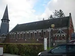
Kirche Saint-Sébastien
- Kirche Saint-Sébastien aus dem 19. Jahrhundert
- Herrenhaus aus dem 18. Jahrhundert
- Park Olhain
This article is issued from Wikipedia. The text is licensed under Creative Commons - Attribution - Sharealike. The authors of the article are listed here. Additional terms may apply for the media files, click on images to show image meta data.