Gâcogne
Gâcogne ist eine französische Gemeinde mit 224 Einwohnern (Stand: 1. Januar 2019) im Département Nièvre in der Region Bourgogne-Franche-Comté. Sie gehört zum Arrondissement Clamecy und zum Kanton Corbigny.
| Gâcogne | ||
|---|---|---|
| ||
| Staat | Frankreich | |
| Region | Bourgogne-Franche-Comté | |
| Département (Nr.) | Nièvre (58) | |
| Arrondissement | Clamecy | |
| Kanton | Corbigny | |
| Gemeindeverband | Tannay-Brinon-Corbigny | |
| Koordinaten | 47° 14′ N, 3° 52′ O | |
| Höhe | 271–577 m | |
| Fläche | 25,61 km² | |
| Einwohner | 224 (1. Januar 2019) | |
| Bevölkerungsdichte | 9 Einw./km² | |
| Postleitzahl | 58140 | |
| INSEE-Code | 58120 | |
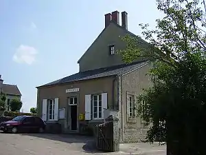 Rathaus (Mairie) von Gâcogne | ||

Geographie
Gâcogne liegt etwa 70 Kilometer nordöstlich von Nevers im Morvan. Umgeben wird Gâcogne von den Nachbargemeinden von Lormes im Norden und Nordwesten, Brassy im Norden und Osten, Ouroux-en-Morvan im Osten und Südosten, Mhère im Süden sowie Vauclaix im Westen.
Bevölkerungsentwicklung
| Jahr | 1962 | 1968 | 1975 | 1982 | 1990 | 1999 | 2006 | 2011 | 2016 |
| Einwohner | 505 | 474 | 415 | 344 | 256 | 250 | 264 | 274 | 256 |
| Quellen: Cassini und INSEE | |||||||||
Sehenswürdigkeiten
- Kirche Saint-Pierre-aux-Liens-Saint-Laurent von 1871
- Schloss Raffigny aus dem 16. Jahrhundert
- Schloss Saugny von 1862
- Schloss Rhuère aus dem 16. Jahrhundert
Literatur
- Le Patrimoine des Communes de la Nièvre. Band 1, Flohic Editions, Charenton-le-Pont 1999, ISBN 2-84234-054-X, S. 319–320.
Weblinks
Commons: Gâcogne – Sammlung von Bildern, Videos und Audiodateien
This article is issued from Wikipedia. The text is licensed under Creative Commons - Attribution - Sharealike. The authors of the article are listed here. Additional terms may apply for the media files, click on images to show image meta data.