La Collancelle
La Collancelle ist eine französische Gemeinde mit 169 Einwohnern (Stand: 1. Januar 2019) im Département Nièvre in der Region Bourgogne-Franche-Comté. Sie gehört zum Arrondissement Clamecy und zum Kanton Corbigny.
| La Collancelle | ||
|---|---|---|
| ||
| Staat | Frankreich | |
| Region | Bourgogne-Franche-Comté | |
| Département (Nr.) | Nièvre (58) | |
| Arrondissement | Clamecy | |
| Kanton | Corbigny | |
| Gemeindeverband | Tannay-Brinon-Corbigny | |
| Koordinaten | 47° 11′ N, 3° 38′ O | |
| Höhe | 235–306 m | |
| Fläche | 23,46 km² | |
| Einwohner | 169 (1. Januar 2019) | |
| Bevölkerungsdichte | 7 Einw./km² | |
| Postleitzahl | 58800 | |
| INSEE-Code | 58080 | |
| Website | http://la-collancelle.monsite.orange.fr/ | |
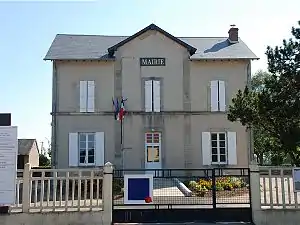 Rathaus (Mairie) von La Collancelle | ||

Geographie
La Collancelle liegt etwa 65 Kilometer südsüdwestlich von Auxerre am Canal du Nivernais. Umgeben wird La Collancelle von den Nachbargemeinden von Pazy im Norden, Sardy-lès-Épiry im Osten und Nordosten, Achun im Süden und Südosten, Bazolles im Süden und Westen sowie Vitry-Laché im Westen und Nordwesten.
Bevölkerungsentwicklung
| Jahr | 1962 | 1968 | 1975 | 1982 | 1990 | 1999 | 2006 | 2011 | 2016 |
| Einwohner | 280 | 225 | 177 | 189 | 209 | 178 | 170 | 179 | 178 |
| Quellen: Cassini und INSEE | |||||||||
Sehenswürdigkeiten
- Kirche Saint-Sulpice aus dem 13. Jahrhundert
- Kanaltunnel bei La Collancelle
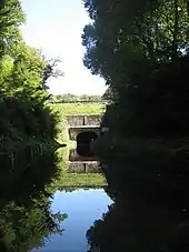
Kanaltunnel von La Collancelle
Literatur
- Le Patrimoine des Communes de la Nièvre. Band 1, Flohic Editions, Charenton-le-Pont 1999, ISBN 2-84234-054-X, S. 305–306.
Weblinks
Commons: La Collancelle – Sammlung von Bildern, Videos und Audiodateien
This article is issued from Wikipedia. The text is licensed under Creative Commons - Attribution - Sharealike. The authors of the article are listed here. Additional terms may apply for the media files, click on images to show image meta data.