Tousson
Tousson ist eine französische Gemeinde im Département Seine-et-Marne in der Region Île-de-France. Sie gehört zum Kanton Fontainebleau im gleichnamigen Arrondissement.
| Tousson | ||
|---|---|---|
| ||
| Staat | Frankreich | |
| Region | Île-de-France | |
| Département (Nr.) | Seine-et-Marne (77) | |
| Arrondissement | Fontainebleau | |
| Kanton | Fontainebleau | |
| Gemeindeverband | Pays de Fontainebleau | |
| Koordinaten | 48° 21′ N, 2° 28′ O | |
| Höhe | 104–133 m | |
| Fläche | 13,27 km² | |
| Einwohner | 363 (1. Januar 2019) | |
| Bevölkerungsdichte | 27 Einw./km² | |
| Postleitzahl | 77123 | |
| INSEE-Code | 77471 | |
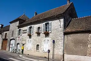 Mairie von Tousson | ||

Geographie
Die Gemeinde liegt im Regionalen Naturpark Gâtinais français. Sie grenzt im Nordwesten an Oncy-sur-École, im Nordosten an Noisy-sur-École, im Südosten an Le Vaudoué, im Süden an Boissy-aux-Cailles, im Südwesten an Nanteau-sur-Essonne und im Westen an Buno-Bonnevaux.
Bevölkerungsentwicklung
| Jahr | 1962 | 1968 | 1975 | 1982 | 1990 | 1999 | 2008 | 2014 |
|---|---|---|---|---|---|---|---|---|
| Einwohner | 370 | 353 | 302 | 292 | 334 | 378 | 382 | 378 |
Sehenswürdigkeiten
Siehe auch: Liste der Monuments historiques in Tousson
- Wasserturm
- Kirche Mariä Geburt (Église Notre-Dame-de-la-Nativité)
- La Cour des rois
- Menhir de la Croix Saint-Jacques
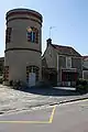 Wasserturm
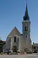 Kirche Mariä Geburt
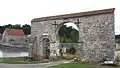 La Cour des rois
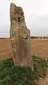 Menhir de la Croix Saint-Jacques
Literatur
- Le Patrimoine des Communes de la Seine-et-Marne. Flohic Editions, Band 1, Paris 2001, ISBN 2-84234-100-7, S. 167–169.
This article is issued from Wikipedia. The text is licensed under Creative Commons - Attribution - Sharealike. The authors of the article are listed here. Additional terms may apply for the media files, click on images to show image meta data.