Le Vaudoué
Le Vaudoué ist eine französische Gemeinde mit 729 Einwohnern (Stand: 1. Januar 2019) im Département Seine-et-Marne in der Region Île-de-France. Sie gehört zum Arrondissement Fontainebleau und zum Kanton Fontainebleau.
| Le Vaudoué | ||
|---|---|---|
.svg.png.webp)
|
| |
| Staat | Frankreich | |
| Region | Île-de-France | |
| Département (Nr.) | Seine-et-Marne (77) | |
| Arrondissement | Fontainebleau | |
| Kanton | Fontainebleau | |
| Gemeindeverband | Pays de Fontainebleau | |
| Koordinaten | 48° 21′ N, 2° 31′ O | |
| Höhe | 66–123 m | |
| Fläche | 17,16 km² | |
| Einwohner | 729 (1. Januar 2019) | |
| Bevölkerungsdichte | 42 Einw./km² | |
| Postleitzahl | 77123 | |
| INSEE-Code | 77485 | |
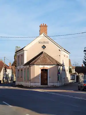 Mairie Le Vaudoué | ||

Geographie
Die Gemeinde liegt im Regionalen Naturpark Gâtinais français.
| Noisy-sur-École | ||
| Tousson | .svg.png.webp) |
Achères-la-Forêt |
| Boissy-aux-Cailles | La Chapelle-la-Reine |
Sehenswürdigkeiten
Siehe auch: Liste der Monuments historiques in Le Vaudoué
- Kirche Saint-Loup
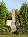 Kriegerdenkmal
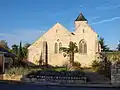 Kirche Saint-Loup
Literatur
- Le Patrimoine des Communes de la Seine-et-Marne. Flohic Editions, Band 1, Paris 2001, ISBN 2-84234-100-7, S. 173–175.
This article is issued from Wikipedia. The text is licensed under Creative Commons - Attribution - Sharealike. The authors of the article are listed here. Additional terms may apply for the media files, click on images to show image meta data.