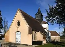
Soirans
Soirans ist eine französische Gemeinde mit 497 Einwohnern (Stand: 1. Januar 2019) im Département Côte-d’Or in der Region Bourgogne-Franche-Comté (vor 2016 Bourgogne). Sie gehört zum Arrondissement Dijon und zum Kanton Auxonne.
| Soirans | ||
|---|---|---|
.svg.png.webp)
|
| |
| Staat | Frankreich | |
| Region | Bourgogne-Franche-Comté | |
| Département (Nr.) | Côte-d’Or (21) | |
| Arrondissement | Dijon | |
| Kanton | Auxonne | |
| Gemeindeverband | Auxonne Pontailler Val de Saône | |
| Koordinaten | 47° 12′ N, 5° 17′ O | |
| Höhe | 189–204 m | |
| Fläche | 4,42 km² | |
| Einwohner | 497 (1. Januar 2019) | |
| Bevölkerungsdichte | 112 Einw./km² | |
| Postleitzahl | 21110 | |
| INSEE-Code | 21609 | |
| Website | https://www.mairie-soirans.fr/ | |

Geographie
Soirans liegt etwa 25 Kilometer ostsüdöstlich von Dijon. Umgeben wird Soirans von den Nachbargemeinden Collonges-lès-Premières im Norden, Villers-les-Pots im Osten, Tréclun im Süden und Südosten sowie Pluvet im Westen und Südwesten.
Durch die Gemeinde führt die Autoroute A39.
Bevölkerungsentwicklung
| Jahr | 1962 | 1968 | 1975 | 1982 | 1990 | 1999 | 2006 | 2013 | |
| Einwohner | 113 | 114 | 118 | 234 | 330 | 361 | 446 | 459 | |
| Quellen: Cassini und INSEE | |||||||||
This article is issued from Wikipedia. The text is licensed under Creative Commons - Attribution - Sharealike. The authors of the article are listed here. Additional terms may apply for the media files, click on images to show image meta data.