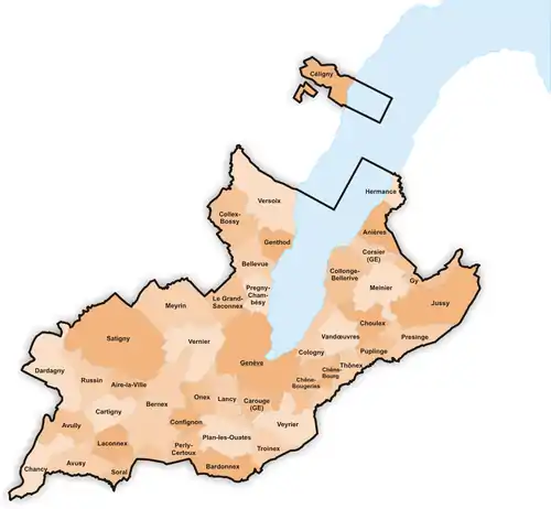
Gemeinden des Kantons Genf
Der Kanton Genf umfasst 45 politische Gemeinden (Stand: Februar 2009). Hauptort ist die gleichnamige Stadt Genf.
Liste der Gemeinden
| Wappen | Name der Gemeinde | Einwohner[1] (31. Dezember 2020) |
Ausländeranteil[1] in Prozent (31. Dezember 2020) |
Fläche in km² [2] |
Einw. pro km² |
|---|---|---|---|---|---|
Aire-la-Ville |
Aire-la-Ville | 1160 | 15,9 | 2,93 | 396 |
Anières |
Anières | 2381 | 32,1 | 3,85 | 618 |
Avully |
Avully | 1756 | 18,1 | 4,62 | 380 |
Avusy |
Avusy | 1391 | 11,7 | 5,17 | 269 |
Bardonnex |
Bardonnex | 2396 | 23,9 | 5,00 | 479 |
Bellevue |
Bellevue | 3467 | 36,7 | 4,36 | 795 |
Bernex |
Bernex | 10'258 | 22,1 | 12,95 | 792 |
Carouge |
Carouge (GE) | 22'536 | 36,7 | 2,70 | 8347 |
Cartigny |
Cartigny | 971 | 21,3 | 4,38 | 222 |
Céligny |
Céligny | 792 | 31,4 | 4,66 | 170 |
Chancy |
Chancy | 1708 | 21,5 | 5,38 | 317 |
Chêne-Bougeries |
Chêne-Bougeries | 12'621 | 34,7 | 4,14 | 3049 |
Chêne-Bourg |
Chêne-Bourg | 8791 | 37,4 | 1,28 | 6868 |
Choulex |
Choulex | 1182 | 22,0 | 3,91 | 302 |
Collex-Bossy |
Collex-Bossy | 1686 | 33,1 | 6,89 | 245 |
Collonge-Bellerive |
Collonge-Bellerive | 8445 | 28,5 | 6,12 | 1380 |
Cologny |
Cologny | 5866 | 34,7 | 3,65 | 1607 |
Confignon |
Confignon | 4579 | 17,1 | 2,77 | 1653 |
Corsier |
Corsier (GE) | 2295 | 30,2 | 2,74 | 838 |
Dardagny |
Dardagny | 1855 | 28,5 | 8,60 | 216 |
Genf |
Genève | 203'856 | 48,3 | 15,93 | 12797 |
Genthod |
Genthod | 2893 | 33,7 | 2,87 | 1008 |
Gy |
Gy | 473 | 15,4 | 4,38 | 2826 |
Hermance |
Hermance | 1073 | 28,3 | 1,44 | 745 |
Jussy |
Jussy | 1233 | 20,4 | 11,35 | 109 |
Laconnex |
Laconnex | 710 | 12,7 | 3,83 | 185 |
Lancy |
Lancy | 33'989 | 35,1 | 4,77 | 7126 |
Le Grand-Saconnex |
Le Grand-Saconnex | 12'378 | 41,3 | 4,38 | 2826 |
Meinier |
Meinier | 2115 | 19,1 | 6,95 | 304 |
Meyrin |
Meyrin | 26'129 | 44,0 | 9,94 | 2629 |
Onex |
Onex | 18'933 | 36,3 | 2,81 | 6738 |
Perly-Certoux |
Perly-Certoux | 3127 | 24,3 | 2,54 | 1231 |
Plan-les-Ouates |
Plan-les-Ouates | 10'601 | 22,3 | 5,85 | 1812 |
Pregny-Chambésy |
Pregny-Chambésy | 3803 | 51,1 | 3,24 | 1174 |
Presinge |
Presinge | 696 | 20,1 | 4,71 | 148 |
Puplinge |
Puplinge | 2488 | 23,7 | 2,67 | 932 |
Russin |
Russin | 530 | 28,9 | 4,91 | 108 |
Satigny |
Satigny | 4286 | 26,8 | 18,92 | 227 |
Soral |
Soral | 976 | 18,2 | 2,94 | 332 |
Thônex |
Thônex | 14'573 | 35,3 | 3,82 | 3815 |
Troinex |
Troinex | 2551 | 22,0 | 3,43 | 744 |
Vandœuvres |
Vandœuvres | 2754 | 30,4 | 4,42 | 623 |
Vernier |
Vernier | 34'898 | 44,2 | 7,69 | 4538 |
Versoix |
Versoix | 13'281 | 42,1 | 10,50 | 1265 |
Veyrier |
Veyrier | 11'861 | 27,7 | 6,50 | 1825 |
Kanton Genf |
Kanton Genf (gesamt) | 506'343 | 40,2 | 282,49 | 1792 |
Die Landfläche des Kantons Genf umfasst 245,82 km², der Seeflächenanteil beträgt 36,67 km² (Genfersee/Lac Léman). Somit beträgt die Gesamtfläche 282,49 km².
Veränderungen im Gemeindebestand
 Gemeinden bis 1849
 Gemeinden bis 1850
 Gemeinden bis 1854
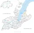 Gemeinden bis 1857
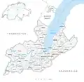 Gemeinden bis 1868
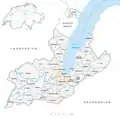 Gemeinden bis 1930
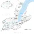 Gemeinden bis 1959
- 1850: Abspaltung von Bernex-Onex-Confignon → Bernex und Onex-Confignon
- 1851: Abspaltung von Compesières → Bardonnex und Plan-les-Ouates
- 1851: Abspaltung von Jussy → Gy
- 1851: Abspaltung von Onex-Confignon → Confignon und Onex
- 1851: Abspaltung von Soral → Laconnex
- 1855: Abspaltung von Collex-Bossy → Bellevue
- 1869: Abspaltung von Chêne-Thônex → Chêne-Bourg und Thônex
- 1931: Fusion Eaux-Vives, Genf, Le Petit-Saconnex und Plainpalais → Genf
- 1960: Namensänderung von Pregny → Pregny-Chambésy
Weblinks
- Kanton Genf: Gemeinden (französisch)
Einzelnachweise
- Ständige Wohnbevölkerung nach Staatsangehörigkeitskategorie, Geschlecht und Gemeinde, definitive Jahresergebnisse, 2020. Bei späteren Gemeindefusionen Einwohnerzahlen aufgrund Stand 2020 zusammengefasst. Abruf am 17. November 2021
- Bundesamt für Statistik Generalisierte Grenzen 2020.
Aire-la-Ville | Anières | Avully | Avusy | Bardonnex | Bellevue | Bernex | Carouge | Cartigny | Céligny | Chancy | Chêne-Bougeries | Chêne-Bourg | Choulex | Collex-Bossy | Collonge-Bellerive | Cologny | Confignon | Corsier | Dardagny | Genf | Genthod | Gy | Hermance | Jussy | Laconnex | Lancy | Le Grand-Saconnex | Meinier | Meyrin | Onex | Perly-Certoux | Plan-les-Ouates | Pregny-Chambésy | Presinge | Puplinge | Russin | Satigny | Soral | Thônex | Troinex | Vandœuvres | Vernier | Versoix | Veyrier
Ehemalige Gemeinden: Bernex-Onex-Confignon | Chêne-Thônex | Compesières | Eaux-Vives | Le Petit-Saconnex | Onex-Confignon | Plainpalais
Kanton Genf | Bezirke der Schweiz | Gemeinden des Kantons Genf