Municipio Zinacantepec
| Zinacantepec | ||
|---|---|---|
 | ||
| Symbole | ||
| ||
| Basisdaten | ||
| Staat | Mexiko | |
| Bundesstaat | México | |
| Sitz | San Miguel Zinacantepec | |
| Fläche | 309,9 km² | |
| Einwohner | 167.759 (2010) | |
| Dichte | 541,3 Einwohner pro km² | |
| Gründung | 1826 | |
| INEGI-Nr. | 15118 | |
| Politik | ||
| Presidente municipal | Olga Hernández Martínez | |
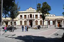 Palacio Municipal | ||

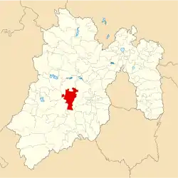
Zinacantepec ist ein Municipio im mexikanischen Bundesstaat México. Es gehört zur Zona Metropolitana del Valle de Toluca, der Metropolregion um Toluca de Lerdo. Der Sitz der Gemeinde ist San Miguel Zinacantepec. Die Gemeinde hatte im Jahr 2010 167.759 Einwohner, ihre Fläche beträgt 309,9 km².
Geographie
Zinacantepec liegt im Zentrum des westlichen Teils des Bundesstaates México, etwa 8 km westlich von Toluca de Lerdo. Zinacantepec befindet sich auf der höchstgelegenen Meseta des Landes auf 2750 m bis 3200 m Höhe. Gut die Hälfte der Gemeindefläche dient dem Ackerbau.
Das Municipio Zinacantepec grenzt an die Municipios Almoloya de Juárez, Toluca, Coatepec Harinas, Temascaltepec und Amanalco.
Städte und Orte
Das Municipio umfasst 56 Orte, 8 davon haben über 5.000 Einwohner, weitere 29 zumindest 500 Einwohner. Die größten Orte des Municipios sind:
| Ortsname | Bevölkerung (2010) |
|---|---|
| San Miguel Zinacantepec | 54.220 |
| San Antonio Acahualco | 16.442 |
| San Juan de las Huertas | 12.253 |
| Ejido San Lorenzo Cuauhtenco | 8.024 |
| Santa Cruz Cuauhtenco | 7.460 |
| Barrio de México | 7.414 |
| Conjunto Urbano La Loma I | 6.192 |
| El Cóporo | 6.068 |
| Santa María del Monte | 3.922 |
| La Joya | 3.800 |
| San Bartolo el Viejo | 3.312 |
| Colonia Morelos | 2.915 |
| Tejalpa | 2.729 |
Weblinks
- Enciclopedia de los Municipios y Delegaciones de México: Municipio Zinacantepec (spanisch)
- INEGI: Datos Geográficos: Municipio Zinacantepec (spanisch; PDF)

Acambay | Acolman | Aculco | Almoloya de Alquisiras | Almoloya de Juárez | Almoloya del Río | Amanalco | Amatepec | Amecameca | Apaxco | Atenco | Atizapán | Atizapán de Zaragoza | Atlacomulco | Atlautla | Axapusco | Ayapango | Calimaya | Capulhuac | Chalco | Chapa de Mota | Chapultepec | Chiautla | Chicoloapan | Chiconcuac | Chimalhuacán | Coacalco de Berriozábal | Coatepec Harinas | Cocotitlán | Coyotepec | Cuautitlán | Cuautitlán Izcalli | Donato Guerra | Ecatepec de Morelos | Ecatzingo | El Oro | Huehuetoca | Hueypoxtla | Huixquilucan | Isidro Fabela | Ixtapaluca | Ixtapan de la Sal | Ixtapan del Oro | Ixtlahuaca | Jaltenco | Jilotepec | Jilotzingo | Jiquipilco | Jocotitlán | Joquicingo | Juchitepec | La Paz | Lerma | Luvianos | Malinalco | Melchor Ocampo | Metepec | Mexicaltzingo | Morelos | Naucalpan de Juárez | Nextlalpan | Nezahualcóyotl | Nicolás Romero | Nopaltepec | Ocoyoacac | Ocuilan | Otumba | Otzoloapan | Otzolotepec | Ozumba | Papalotla | Polotitlán | Rayón | San Antonio la Isla | San Felipe del Progreso | San José del Rincón | San Martín de las Pirámides | San Mateo Atenco | San Simón de Guerrero | Santo Tomás | Soyaniquilpan de Juárez | Sultepec | Tecámac | Tejupilco | Temamatla | Temascalapa | Temascalcingo | Temascaltepec | Temoaya | Tenancingo | Tenango del Aire | Tenango del Valle | Teoloyucan | Teotihuacán | Tepetlaoxtoc | Tepetlixpa | Tepotzotlán | Tequixquiac | Texcaltitlán | Texcalyacac | Texcoco | Tezoyuca | Tianguistenco | Timilpan | Tlalmanalco | Tlalnepantla de Baz | Tlatlaya | Toluca | Tonanitla | Tonatico | Tultepec | Tultitlán | Valle de Bravo | Valle de Chalco Solidaridad | Villa de Allende | Villa del Carbón | Villa Guerrero | Villa Victoria | Xalatlaco | Xonacatlán | Zacazonapan | Zacualpan | Zinacantepec | Zumpahuacán | Zumpango