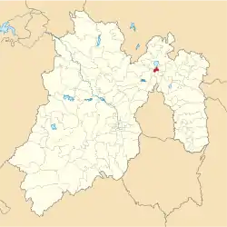
Municipio Melchor Ocampo (México)
| Melchor Ocampo | ||
|---|---|---|
 | ||
| Symbole | ||
| ||
| Basisdaten | ||
| Staat | Mexiko | |
| Bundesstaat | México | |
| Sitz | Melchor Ocampo | |
| Fläche | 17,9 km² | |
| Einwohner | 50.240 (2010) | |
| Dichte | 2.799,7 Einwohner pro km² | |
| Webauftritt | melchor-ocampo.gob.mx | |
| INEGI-Nr. | 15053 | |
| Politik | ||
| Presidente municipal | Isidro Rivas Juárez | |
Melchor Ocampo ist ein Municipio im mexikanischen Bundesstaat México. Es gehört zur Zona Metropolitana del Valle de México, der Metropolregion um Mexiko-Stadt. Die Gemeinde hatte im Jahr 2010 50.240 Einwohner, ihre Fläche beträgt 17,9 km².
Verwaltungssitz und größter der neun Orte im Municipio ist das gleichnamige, auch als San Miguel Tlaxomulco bekannte Melchor Ocampo. Weitere größere Ansiedlungen im Municipio sind Colonia 2 de Septiembre, San Francisco Tenopalco und Lomas de Tenopalco.
Geographie
Melchor Ocampo liegt etwa 20 km nördlich der Stadtgrenze von Mexiko-Stadt auf etwa 2260 m Höhe.
Das Municipio Melchor Ocampo grenzt an die Municipios Cuautitlán, Teoloyucan, Nextlalpan und Tultepec.
Weblinks
- Enciclopedia de los Municipios y Delegaciones de México: Municipio Melchor Ocampo (spanisch)
- INEGI: Datos Geográficos: Municipio Melchor Ocampo (spanisch; PDF)
This article is issued from Wikipedia. The text is licensed under Creative Commons - Attribution - Sharealike. The authors of the article are listed here. Additional terms may apply for the media files, click on images to show image meta data.

