Municipio Coyotepec (México)
| Coyotepec | ||
|---|---|---|
 | ||
| Symbole | ||
| ||
| Basisdaten | ||
| Staat | Mexiko | |
| Bundesstaat | México | |
| Sitz | Coyotepec | |
| Fläche | 47,8 km² | |
| Einwohner | 39.030 (2010) | |
| Dichte | 817,1 Einwohner pro km² | |
| Gründung | 1853 | |
| INEGI-Nr. | 15023 | |
| Politik | ||
| Presidente municipal | Alfredo Anguiano Fuentes | |
.JPG.webp) | ||

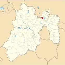
Coyotepec ist ein Municipio im mexikanischen Bundesstaat México. Es gehört zur Zona Metropolitana del Valle de México, der Metropolregion um Mexiko-Stadt. Der Sitz der Gemeinde und dessen größter Ort ist das gleichnamige Coyotepec, der zweitgrößte Ort im Municipio ist La Planada. Die Gemeinde hatte im Jahr 2010 39.030 Einwohner, ihre Fläche beträgt 47,8 km².
Geographie
Coyotepec liegt im Nordosten des Bundesstaates México, etwa 30 km nördlich von Mexiko-Stadt.
Das Municipio grenzt an die Municipios Huehuetoca, Zumpango, Teoloyucan und Tepotzotlán.
Weblinks
- Enciclopedia de los Municipios y Delegaciones de México: Municipio Coyotepec (spanisch)
- INEGI: Datos Geográficos: Municipio Coyotepec (spanisch; PDF)

Acambay | Acolman | Aculco | Almoloya de Alquisiras | Almoloya de Juárez | Almoloya del Río | Amanalco | Amatepec | Amecameca | Apaxco | Atenco | Atizapán | Atizapán de Zaragoza | Atlacomulco | Atlautla | Axapusco | Ayapango | Calimaya | Capulhuac | Chalco | Chapa de Mota | Chapultepec | Chiautla | Chicoloapan | Chiconcuac | Chimalhuacán | Coacalco de Berriozábal | Coatepec Harinas | Cocotitlán | Coyotepec | Cuautitlán | Cuautitlán Izcalli | Donato Guerra | Ecatepec de Morelos | Ecatzingo | El Oro | Huehuetoca | Hueypoxtla | Huixquilucan | Isidro Fabela | Ixtapaluca | Ixtapan de la Sal | Ixtapan del Oro | Ixtlahuaca | Jaltenco | Jilotepec | Jilotzingo | Jiquipilco | Jocotitlán | Joquicingo | Juchitepec | La Paz | Lerma | Luvianos | Malinalco | Melchor Ocampo | Metepec | Mexicaltzingo | Morelos | Naucalpan de Juárez | Nextlalpan | Nezahualcóyotl | Nicolás Romero | Nopaltepec | Ocoyoacac | Ocuilan | Otumba | Otzoloapan | Otzolotepec | Ozumba | Papalotla | Polotitlán | Rayón | San Antonio la Isla | San Felipe del Progreso | San José del Rincón | San Martín de las Pirámides | San Mateo Atenco | San Simón de Guerrero | Santo Tomás | Soyaniquilpan de Juárez | Sultepec | Tecámac | Tejupilco | Temamatla | Temascalapa | Temascalcingo | Temascaltepec | Temoaya | Tenancingo | Tenango del Aire | Tenango del Valle | Teoloyucan | Teotihuacán | Tepetlaoxtoc | Tepetlixpa | Tepotzotlán | Tequixquiac | Texcaltitlán | Texcalyacac | Texcoco | Tezoyuca | Tianguistenco | Timilpan | Tlalmanalco | Tlalnepantla de Baz | Tlatlaya | Toluca | Tonanitla | Tonatico | Tultepec | Tultitlán | Valle de Bravo | Valle de Chalco Solidaridad | Villa de Allende | Villa del Carbón | Villa Guerrero | Villa Victoria | Xalatlaco | Xonacatlán | Zacazonapan | Zacualpan | Zinacantepec | Zumpahuacán | Zumpango