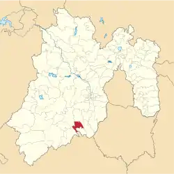
Municipio Ixtapan de la Sal
| Ixtapan de la Sal | ||
|---|---|---|
 | ||
| Symbole | ||
| ||
| Basisdaten | ||
| Staat | Mexiko | |
| Bundesstaat | México | |
| Sitz | Ixtapan de la Sal | |
| Fläche | 111,2 km² | |
| Einwohner | 33.541 (2010) | |
| Dichte | 301,5 Einwohner pro km² | |
| Gründung | 1822 | |
| Webauftritt | www.ixtapandelasal.gob.mx/ | |
| INEGI-Nr. | 15040 | |
| Politik | ||
| Presidente municipal | Ignacio Ávila Navarrete | |
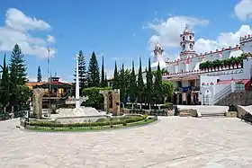 Hauptplatz von Ixtapan de la Sal | ||

Ixtapan de la Sal ist ein Municipio im mexikanischen Bundesstaat México. Die Gemeinde hatte im Jahr 2010 33.541 Einwohner, ihre Fläche beträgt 111,2 km².
Verwaltungssitz und größter Ort des Municipios ist das gleichnamige Ixtapan de la Sal, die nächstgrößeren Orte im Municipio sind Tecomatepec, San Alejo und Ahuacatitlán.
Geographie
Ixtapan de la Sal liegt im Süden des westlichen Teiles des Bundesstaates México, etwa 50 km südlich Toluca de Lerdos auf 1924 bis 2020 m Seehöhe.
Das Municipio Ixtapan de la Sal grenzt an die Municipios Coatepec Harinas, Villa Guerrero, Zumpahuacán, Tonatico und Zacualpan sowie an den Bundesstaat Guerrero.
Weblinks
- Enciclopedia de los Municipios y Delegaciones de México: Municipio Ixtapan de la Sal (spanisch)
- INEGI: Datos Geográficos: Municipio Ixtapan de la Sal (spanisch; PDF)

Acambay | Acolman | Aculco | Almoloya de Alquisiras | Almoloya de Juárez | Almoloya del Río | Amanalco | Amatepec | Amecameca | Apaxco | Atenco | Atizapán | Atizapán de Zaragoza | Atlacomulco | Atlautla | Axapusco | Ayapango | Calimaya | Capulhuac | Chalco | Chapa de Mota | Chapultepec | Chiautla | Chicoloapan | Chiconcuac | Chimalhuacán | Coacalco de Berriozábal | Coatepec Harinas | Cocotitlán | Coyotepec | Cuautitlán | Cuautitlán Izcalli | Donato Guerra | Ecatepec de Morelos | Ecatzingo | El Oro | Huehuetoca | Hueypoxtla | Huixquilucan | Isidro Fabela | Ixtapaluca | Ixtapan de la Sal | Ixtapan del Oro | Ixtlahuaca | Jaltenco | Jilotepec | Jilotzingo | Jiquipilco | Jocotitlán | Joquicingo | Juchitepec | La Paz | Lerma | Luvianos | Malinalco | Melchor Ocampo | Metepec | Mexicaltzingo | Morelos | Naucalpan de Juárez | Nextlalpan | Nezahualcóyotl | Nicolás Romero | Nopaltepec | Ocoyoacac | Ocuilan | Otumba | Otzoloapan | Otzolotepec | Ozumba | Papalotla | Polotitlán | Rayón | San Antonio la Isla | San Felipe del Progreso | San José del Rincón | San Martín de las Pirámides | San Mateo Atenco | San Simón de Guerrero | Santo Tomás | Soyaniquilpan de Juárez | Sultepec | Tecámac | Tejupilco | Temamatla | Temascalapa | Temascalcingo | Temascaltepec | Temoaya | Tenancingo | Tenango del Aire | Tenango del Valle | Teoloyucan | Teotihuacán | Tepetlaoxtoc | Tepetlixpa | Tepotzotlán | Tequixquiac | Texcaltitlán | Texcalyacac | Texcoco | Tezoyuca | Tianguistenco | Timilpan | Tlalmanalco | Tlalnepantla de Baz | Tlatlaya | Toluca | Tonanitla | Tonatico | Tultepec | Tultitlán | Valle de Bravo | Valle de Chalco Solidaridad | Villa de Allende | Villa del Carbón | Villa Guerrero | Villa Victoria | Xalatlaco | Xonacatlán | Zacazonapan | Zacualpan | Zinacantepec | Zumpahuacán | Zumpango